Round Island Route Singapore: What Cyclists Need To Know
The Round Island Route is Singapore's most ambitious cycling project: a planned 150 km loop around the entire island, of which a 75 km eastern half is already open and ridable. Here is what the route covers, where to join it, and how a guided tour can carry you through the best of it.
Short answer
The Round Island Route is a planned continuous 150 km park connector, part of a 360 km island-wide network. Phase 1 opened on 22 January 2022 and covers 75 km along the eastern half, from Rower's Bay past the Singapore River to Berlayer Creek. Guided sections of the route start from $47 per person.
Singapore has been building a continuous cycling loop around the entire island, and a large part of it is already on the ground. The Round Island Route, usually shortened to RIR, is a planned continuous 150 km park connector that will eventually let a rider circle the country on dedicated and shared paths without ever joining fast traffic. The first phase has been open since 22 January 2022, and it is a real, signed, rideable route rather than a plan on paper: 75 km across the eastern half of the island, from Rower's Bay in the north-east down past the Singapore River to Berlayer Creek in the south. If the RIR sounds like more distance than you need, the guide to picking Singapore's best cycling spot by rider type compares shorter options from Marina Bay to Pulau Ubin.
That matters for two kinds of rider. Locals treat the eastern half as a weekend endurance objective, often split into two or three sessions. Visitors, though, rarely want to read 75 km of park connector signs alone on a holiday morning, which is why guided rides that cover slices of the same coastline, from the Changi Bay bridges to the Singapore River, have become the practical way for a tourist to experience the route. This page lays out what the route is, where you can join it, the rules that apply on it, and the tour options that fit it, including the Airport Coastline Ride, 2 Hours, which starts at Changi Airport Terminal 2, right beside the route's easternmost stretch. If the eastern end of the route appeals most, our Changi coastal cycling guide covers the boardwalks, the ferry to Pulau Ubin, and where the shoreline riding is at its best.
What Is The Round Island Route In Singapore?
The Round Island Route is a planned continuous 150 km park connector around Singapore, part of a wider 360 km island-wide recreational network. Phase 1 opened on 22 January 2022 and covers 75 km across the eastern half of the island, running from Rower's Bay in the north-east past the Singapore River to Berlayer Creek in the south.
The route is an NParks project, and its logic is simple: Singapore already has over 350 km of park connectors linking parks, rivers and nature areas, but they form a web rather than a loop. The RIR stitches the eastern connectors, waterfront paths and new purpose-built links into one continuous line, so that a rider could in principle leave Rower's Bay in the morning and arrive at Berlayer Creek without backtracking. The NParks route page describes it as part of a 360 km island-wide network of recreational routes, of which the 150 km loop is the flagship.
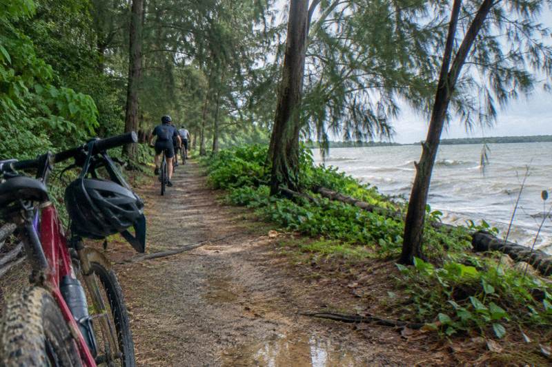
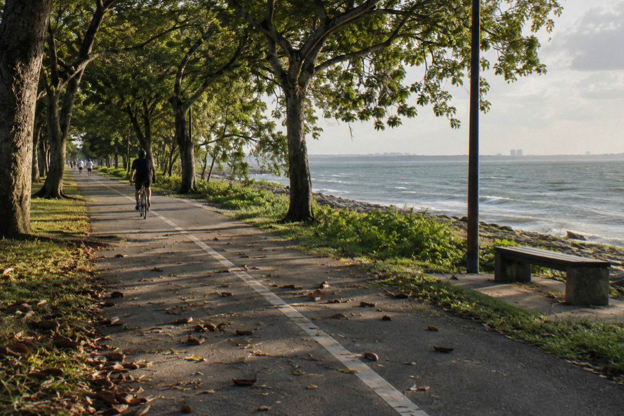
What surprises many first-time riders is how little of it feels urban. The eastern half passes reservoirs, riverine parks and long stretches of open coast, and only occasionally dips into the dense city around the Singapore River. The engineering is also more ambitious than a typical park path. Two purpose-built cycling bridges carry the route over the water at Changi Bay, with a combined length of 140 m, plus a boardwalk and a lookout pavilion at the same bay, and a dedicated crossing at Sengkang Riverside Bridge. This is infrastructure built for cyclists first.
| Route fact | Detail |
|---|---|
| Planned full length | 150 km, continuous |
| Wider network | Part of a 360 km island-wide recreational route network |
| Phase 1 length | 75 km across the eastern half |
| Phase 1 opened | 22 January 2022 |
| Northern trailhead | Rower's Bay |
| Southern endpoint | Berlayer Creek, near Alexandra Road |
| Signature structures | Two cycling bridges at Changi Bay, 140 m total |
Where Does Phase 1 Of The Route Run?
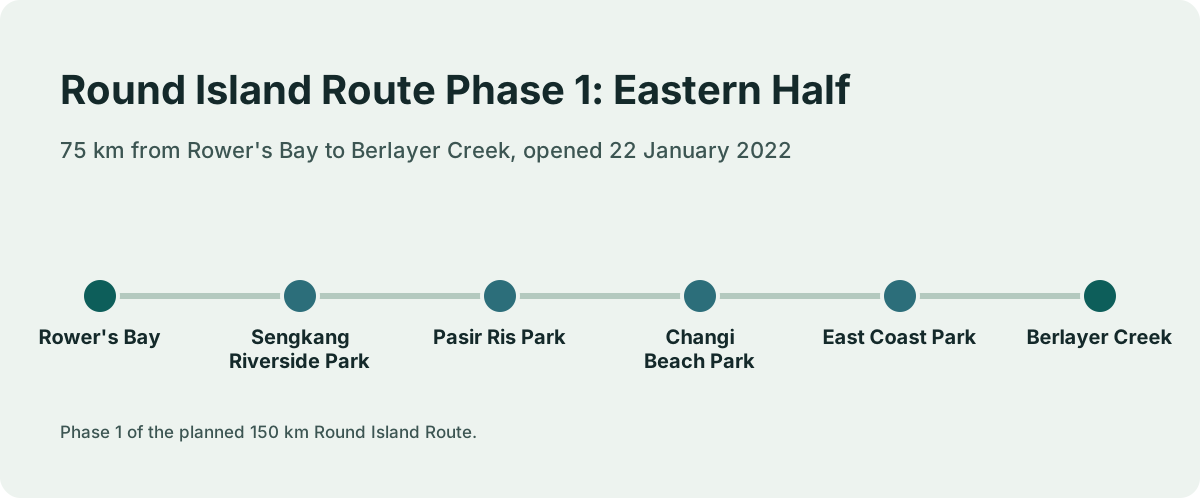
The completed eastern half starts at Rower's Bay near the reservoirs of the north-east and runs south through Sengkang Riverside Park, Pasir Ris Park, Changi Beach Park and East Coast Park, ending at Berlayer Creek in the south. Two dedicated cycling bridges at Changi Bay, 140 m in total, carry riders over open water on the easternmost stretch.
The five parks named in the NParks description are the spine of the phase, and each marks a change in scenery. Rower's Bay sits at the northern end near Lower Seletar Reservoir, where the route begins among water and quiet parkland. Sengkang Riverside Park brings the first riverine stretch, with wetland greenery along the banks. Pasir Ris Park adds coastal woodland, and Changi Beach Park delivers the long, flat seafront that most riders remember afterwards. East Coast Park is the biggest name on the list, a beachfront park with kilometers of straight path, and Berlayer Creek at Labrador marks the southern terminus near the port.
The route also threads past the Singapore River on its way south, which is where it comes closest to the civic and financial district. That central touchpoint is what connects the RIR to the guided city rides described later on this page: the same river paths that a 2 hour tour covers in the evening are a segment of the much longer route. Riders who want the full picture of how these paths connect can compare the RIR against the wider network in the Singapore park connector guide, which maps the shared and segregated path types you will meet along the way.
How Do You Join The Route And Where Does Each Section Start?
Riders can join at several signed points, including Pasir Ris Park toilet A2, Changi Beach Park carpark 7, East Coast Park Area H and Area A, and Berlayer Creek at the Alexandra Road and Telok Blangah Road junction. The northern trailhead at Rower's Bay anchors the route in the north-east, and every listed access point links into the wider park connector network.
The access points matter because 75 km is not a ride you start anywhere. Each entry point defines a sensible section: join at Pasir Ris and ride south to Changi for a reservoir-and-coast leg, or join at East Coast Park Area H and ride north. NParks lists these entry points on the route page, and the practical advice is to pick a segment that ends somewhere with food, shade and a taxi rank or MRT within reach, because the route's whole appeal is that it passes through parks rather than towns.
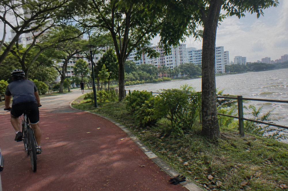
For visitors without a bike, the entry points are also where rental logistics bite. Some parks and park connector pitstops along the Eastern Coastal Loop and North Eastern Riverine Loop have rental operators, and the broader options are covered in the bike rental in Singapore guide. The alternative, and the one most visitors settle on, is a guided ride that includes the bike, which removes both the rental question and the route-finding question in one booking.
If your interest is the eastern coastline rather than the city end, the Airport Coastline Ride, 2 Hours starts at Changi Airport Terminal 2, a short hop from the Changi Bay bridges and the Jurassic Mile coastal path. It runs from $93 per person, covers a scenic coastal route with a safety briefing and photo stops, and finishes with a sandwich at the end of the ride.
What Will You Pass On The Eastern Half?
The eastern half moves through reservoir greenery, riverine parks, coastal beachfront and one stretch of purpose-built cycling infrastructure at Changi Bay. Highlights include the Sengkang Riverside Bridge, the boardwalk and lookout pavilion at Changi Bay, and the long open coastline of Changi Beach Park and East Coast Park. The character shifts every few kilometres, from shaded parkland to exposed seafront.
Rower's Bay first. The northern trailhead sits by the water at Lower Seletar, and the early kilometres run through quiet, shaded connectors where the traffic noise drops away. Sengkang Riverside Park follows, a wetland park with a floating wetland boardwalk and riverside paths, crossed by the dedicated Sengkang Riverside Bridge that NParks names among the route's features. This is the greenest third of the ride, and the one where birdlife is most obvious.
- Jan222 mm
- Feb105 mm
- Mar152 mm
- Apr164 mm
- May164 mm
- Jun135 mm
- Jul147 mm
- Aug147 mm
- Sep125 mm
- Oct168 mm
- Nov252 mm
- Dec332 mm
Rain-days run from 8.5 (driest month) to 19.3 (wettest month).
Then the route turns east toward the sea. Changi Beach Park offers flat, straight kilometres along the water, and beyond it sits Changi Bay, where the route's most photogenic engineering lives: two cycling bridges totalling 140 m, a boardwalk and a lookout pavilion, all built so riders can cross the bay rather than detour inland. The NParks cycling pages treat this stretch as a destination in itself, and the Jurassic Mile path nearby runs beside the airport perimeter, which is why the airport bike tour described above starts where it does.
East Coast Park completes the eastern half in familiar style: a broad beachfront path with food courts, rental kiosks and views of ships at anchor, before the route turns inland past the Singapore River and down to Berlayer Creek. For a deeper look at the Changi end, the Changi cycling guide covers the coastline paths, the Jurassic Mile and the airport perimeter in detail.
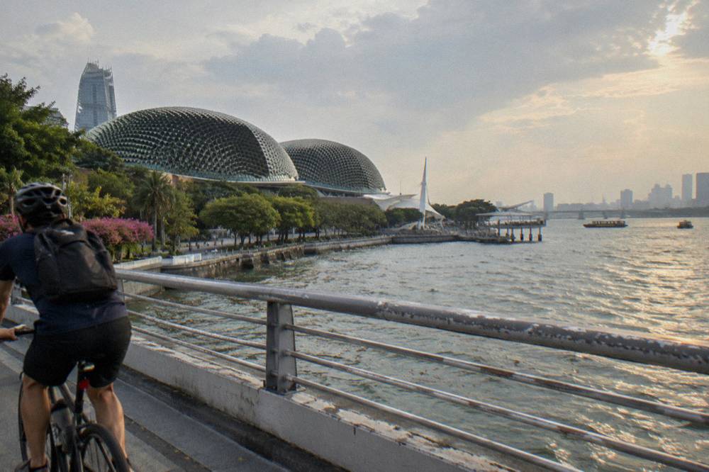
The sunrise end of the route deserves special mention. The Sunrise Ride, Local Breakfast starts at Punggol Field in the north-east, within reach of the route's early reservoir sections, runs 3 to 4 hours, and includes breakfast, a helmet, bottled water, a souvenir and a disposable poncho from $48.02 per person. It has 3 reviews on its booking page so far. Riders who want the quiet-water light of a Punggol morning without route-finding alone tend to book it for exactly that.
How Long Does It Take To Cycle Around Singapore?
There is no single fixed answer, because a ride around Singapore depends entirely on pace, fitness, weather and how long you linger at each park. The completed eastern half measures 75 km end to end, and the full 150 km loop has not yet opened, so no official full-loop time exists today. The honest approach is to plan by section, not by total hours.
The reason this question has no clean answer is structural. The RIR is a park connector, not a race course: it crosses junctions, Attention Zones where riders are asked to slow, stretches shared with pedestrians, and sections where dismount signs appear. A rider pushing hard on a road bike might move quickly through the beachfront kilometres, while a family on comfort bikes with a laksa stop in the middle will take vastly longer for the same distance. Weather changes it again, and a tropical downpour that sends everyone under shelter can add an unplanned hour without anyone feeling slow.
What can be stated as fact is the distance: 75 km for the open eastern half, 150 km planned for the full loop. Locals commonly split the eastern half into a north and a south ride, using the access points listed earlier as their start and end. Visitors with a single morning to spare almost always pick one section instead, and a guided 2 hour ride around the central river end or the eastern coastline delivers the flavour of the route without the commitment. For riders weighing distances across the island, the Singapore cycling routes guide compares shorter loops against the RIR's scale.
Practical planning beats abstract timing. Decide how far you want to ride before you start, pick the access point that matches, carry more water than feels necessary in the heat, and treat the route as a series of connected park rides rather than one continuous effort. This site, Singapore Bike Tours, exists because that planning burden is real, and a guide who knows the turns is worth the fee on any ride longer than a city lap.
Which Cycling Rules Apply On The Route?
On shared paths and cycling paths along the route the limit is 25 km/h, and on footpaths it is 10 km/h. Since 1 July 2025, bicycles and non-motorised PMDs are not allowed on footpaths converted to Pedestrian-Only Paths, and first offences there carry penalties of up to $2,000 and/or three months in prison. Helmets are mandatory when riding on roads.
The RIR is a public path network, so the Active Mobility Act applies everywhere on it, and the speed limits follow path type rather than route name. The LTA code of conduct sets 25 km/h on cycling paths and shared paths, and 10 km/h on footpaths. Where the route shares space with pedestrians, NParks etiquette asks riders to keep left, slow at the red-dotted Attention Zones near bus stops, crossings and playgrounds, and give way to people on foot.
- Bike23 of 23
- Guide19 of 23
- Drinks14 of 23
- Helmet11 of 23
- Meal or food stop8 of 23
A listing that does not mention an item is not counted as leaving it out.
The pedestrian-only rule deserves particular attention from anyone riding in the newer eastern towns. Since 1 July 2025, footpaths that sit beside dedicated cycling paths, over 200 km of them across areas including Tampines, Punggol and Sengkang, have been converted to Pedestrian-Only Paths where bicycles are prohibited outright. LTA's enforcement release states that first-time offenders face penalties of up to $2,000 and/or up to three months imprisonment, and that enforcement officers take a measured approach except toward riders who speed or ride recklessly. On the RIR itself you will mostly be on shared or cycling paths, but any detour through a housing estate can put you beside one of these converted footpaths, so the rule is worth knowing before you go. The full picture for visitors, including group-size limits and night riding lights, is in the Singapore cycling rules for visitors guide.
| Path type | Marking | Speed limit |
|---|---|---|
| Cycling path | Red or dark grey, cyclist logo | 25 km/h |
| Shared path | Cyclist and pedestrian logos | 25 km/h |
| Footpath | Unmarked path beside roads | 10 km/h |
| Pedestrian-Only Path | Beside a cycling path | Bicycles not allowed |
| Road | Excluding expressways and tunnels | Road speed limit, helmet mandatory |
A few more rules shape group riding. On roads, riders must wear a helmet, keep to the left, ride single file on single-lane roads and during bus lane hours, and stay in groups of no more than 5 in single file or 10 two abreast, with around 30 m kept between groups. On the park connectors, NParks advises helmets, single file and lights at night. None of this is exotic, but a 75 km route inevitably crosses roads and bus interchanges, and the rules are enforced, with police issuing about 650 cyclist summonses in the second half of 2025, mostly for failing to obey traffic signals and helmet rules on roads.
When Is The Best Time Of Year To Ride The Route?
February is the driest month in the Changi climate record, averaging 105.1 mm of rain over 8.5 rain days, while December is the wettest, with 331.9 mm over 19.3 rain days. The northeast monsoon from December to early March, together with November, forms the wettest window. Riders planning long stretches should watch the sky rather than the calendar.
- Up to 2 hours4 tours
- 3 to 4 hours17 tours
- 5 to 6 hours1 tour
- 7 hours or more1 tour
The figures come from the Meteorological Service Singapore 1991 to 2020 normals for Changi, which is the station that matters for the eastern coast. The seasonal shape is consistent: February stands out as the dry sweet spot with the most sunshine of any month at 7.0 hours per day, while November and December deliver roughly three times February's rainfall and nearly 19 rain days each month. May is the hottest month on the 24-hour mean at 28.6 C, though the difference from February is modest, and humidity stays near 82 percent across the year, which is what makes heat management matter more than temperature alone.
| Month | Mean temp C | Rainfall mm | Rain days | Sunshine h/day |
|---|---|---|---|---|
| February | 27.3 | 105.1 | 8.5 | 7.0 |
| May | 28.6 | 164.3 | 14.5 | 6.0 |
| October | 27.9 | 168.3 | 15.0 | 5.0 |
| November | 27.2 | 252.3 | 19.0 | 4.4 |
| December | 26.8 | 331.9 | 19.3 | 4.3 |
Two practical conclusions follow. First, the time of day matters more than the time of year: early morning rides avoid both the midday heat and the afternoon convective showers that build on humid days, which is exactly why the sunrise tours in the north-east exist. Second, rain on this route is a delay, not a disaster, because the showers tend to be heavy and short, and every park on the route has shelter within riding distance. The trade-offs are laid out properly in the best time to cycle in Singapore guide.
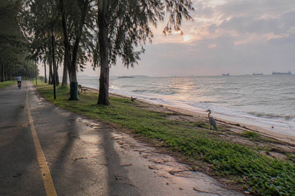
For evening riders, the central end of the route has a dedicated option. The Marina Bay Night Ride, 2 Hours starts from the operator's shop, covers the lit waterfront around Marina Bay after dark, runs 2 hours from $48.02 per person, and carries a 4.9 rating across 598 reviews, with helmet, guide, bottled water and a rain poncho included. It is not an RIR ride end to end, but it uses the same central river-and-bay paths the route touches on its way to Berlayer Creek.
Can A Guided Ride Cover Part Of The Route?
Yes. Several guided rides cover territory the route passes through, from the Changi coastline to the Singapore River and the park fringes of Punggol. A guide removes the route-finding burden on a ride where a missed turn can add kilometres, and every tour described here runs on regular bicycles with the bike included in the price.
The match works both ways. A visitor who wants the RIR's scenery without its logistics can book a guided section and be on the correct path within minutes of leaving the meeting point, and a visitor who only wanted a city tour often discovers the route exists at all through one of these rides. The strongest overlap is at the eastern end, where the coastline path beside the airport sits directly on the route's boldest stretch, and in the centre, where the river paths near the southern terminus are the same ones a short city ride covers.
| Guided ride | Duration | Meeting point | Price per person | Reviews |
|---|---|---|---|---|
| Airport Coastline Ride, 2 Hours | 2 hours | Changi Airport Ter 2 | From $93 | New listing |
| 5-Hour Nature Ride | 5 hours | GoCycling @ Punggol Park | From $84.04 | 5.0 across 37 reviews |
| River Route via F1 Track | 2 hours | City Scoot at Esplanade Mall | From $47 | 14 reviews |
| Sunrise Ride, Local Breakfast | 3 to 4 hours | Punggol Field | From $48.02 | 3 reviews |
| Marina Bay Night Ride, 2 Hours | 2 hours | Crawford Lane, Old Town | From $48.02 | 4.9 across 598 reviews |
| Small Group, Max 10 Guests | 4 hours | City Scoot at Esplanade Mall | From $64.03 | 4.8 across 74 reviews |
The 5-Hour Nature Ride is the deepest option for riders who want the route's green character without its city kilometres. It starts at GoCycling @ Punggol Park in the north-east, within reach of the route's reservoir end, runs 5 hours from $84.04 per person, and carries a 5.0 rating across 37 reviews, with helmet, bottled water, a free bandana and a disposable poncho in bad weather all included, in groups of no more than 4.
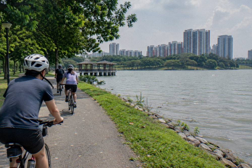
Closer to the city, the River Route via F1 Track starts at City Scoot at Esplanade Mall and covers the river-side paths the RIR passes on its way south, in 2 hours from $47 per person, with 14 reviews so far. And for a broader small-group format, the Small Group, Max 10 Guests ride runs 4 hours from $64.03 per person with a licensed guide, helmet, bottled water, a raincoat and bag storage included, rated 4.8 across 74 reviews, with riders asked to arrive 15 minutes early for bike setup.
One caution ties this back to the route itself. No guided ride on this site covers the full 75 km eastern half, because a guided tour is built around a morning or an afternoon, not an endurance day. If completing the whole half is your goal, the realistic path is a rental bike, an early start, and the access-point plan from earlier on this page, with a guided ride saved for a second visit or a rest day. Riders comparing formats in detail will find the trade-offs in the private versus group bike tour guide.
Common Questions About The Round Island Route
How Long Does It Take To Cycle Around Singapore?
It depends entirely on pace, fitness, weather and how long you stop at each park, so there is no fixed answer. The completed eastern half of the Round Island Route measures 75 km end to end, and the full 150 km loop has not yet opened. Most riders treat the route as a series of connected sections rather than one continuous effort.
Is The Full 150 Km Route Open Yet?
No. Only Phase 1 is open, the 75 km eastern half launched on 22 January 2022, running from Rower's Bay past the Singapore River to Berlayer Creek. The full 150 km loop remains planned within the wider 360 km island-wide network.
Are Bicycles Allowed On The Round Island Route Tracks?
Yes. NParks states that bicycles and PMDs are allowed on RIR tracks marked with the cyclist logo. Standard Active Mobility Act rules still apply, including the 25 km/h limit on shared and cycling paths and the ban on riding converted Pedestrian-Only Paths.
Do You Need A Helmet On The Round Island Route?
On any road section along the route, yes, a helmet is legally mandatory for cyclists. On the park connectors and shared paths a helmet is advisory rather than required, and NParks recommends protective gear. Most guided rides described here include a helmet in the price.
Where Does The Round Island Route Start?
The open eastern half starts at Rower's Bay in the north-east, near Lower Seletar Reservoir, and runs south to Berlayer Creek at the Alexandra Road and Telok Blangah Road junction. Riders can also join at intermediate points such as Pasir Ris Park, Changi Beach Park carpark 7 and East Coast Park Areas H and A.