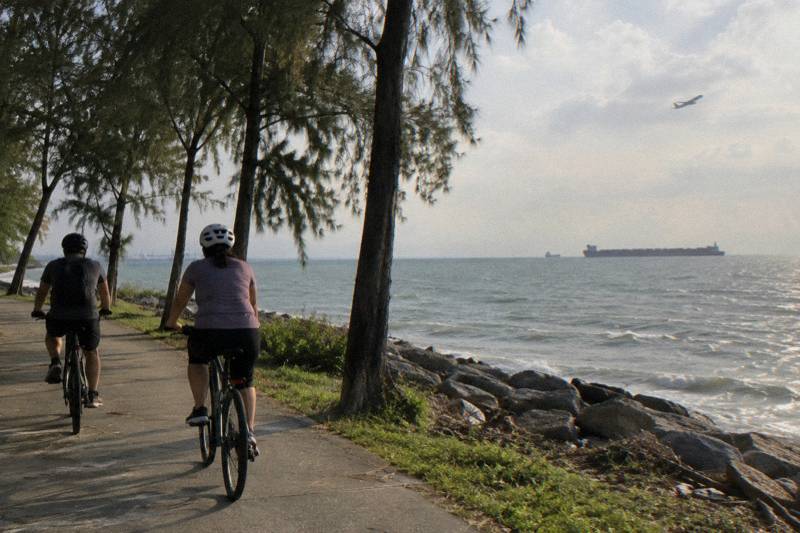
Changi Cycling: Coastal Route, Boardwalk And Beach Park
Changi is the quiet eastern corner of Singapore where the Round Island Route meets the sea, the airport meets a beach park, and a short ferry hop meets Pulau Ubin. Here is what the riding is actually like, which paths allow bicycles, and which guided rides cover it.
Short answer
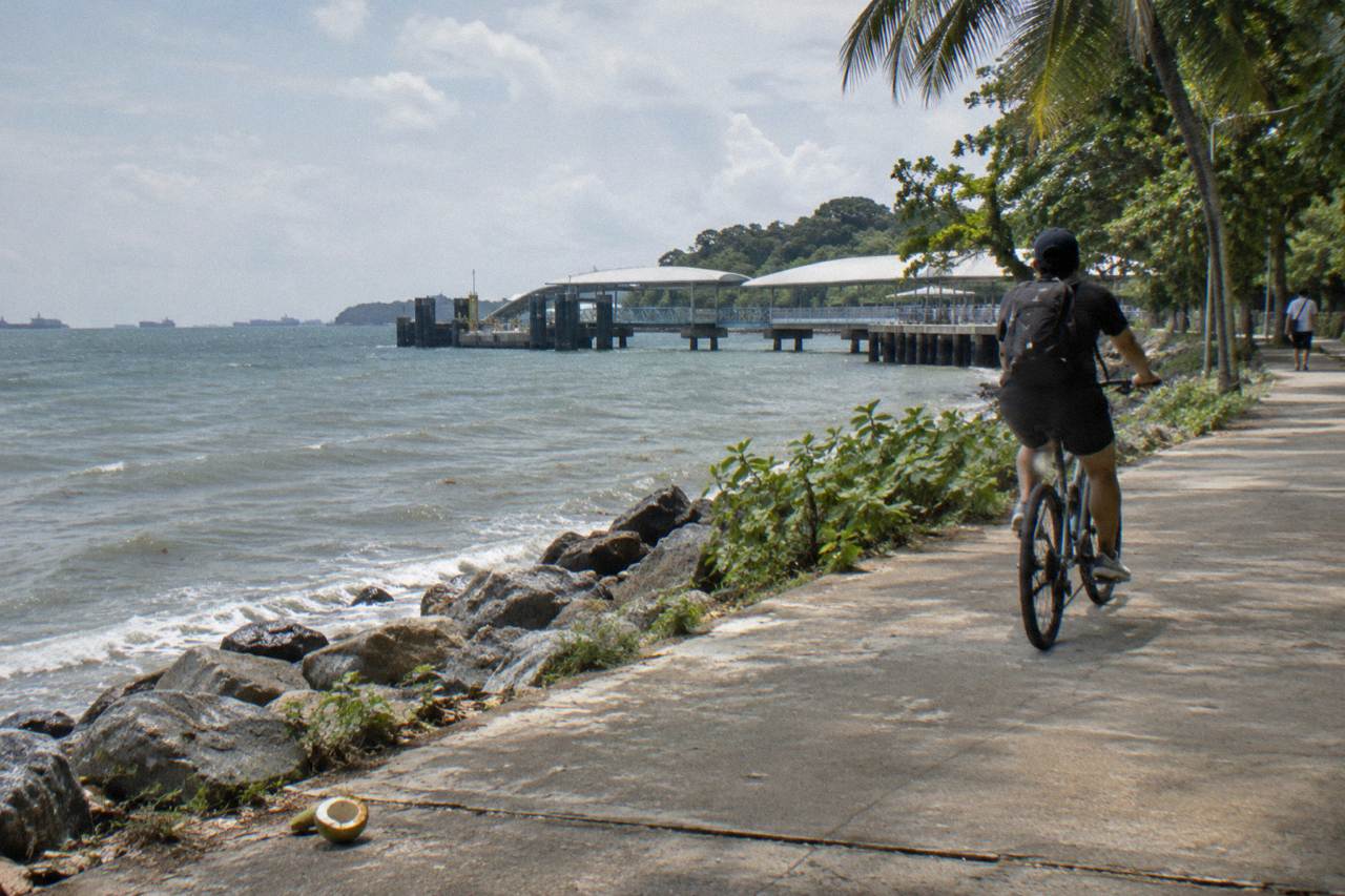
Changi offers the flattest coastal riding in Singapore: the Round Island Route's Changi Bay stretch with two cycling bridges (140 m total), a boardwalk and lookout pavilion, plus Changi Beach Park and the Changi Point ferry crossing to Pulau Ubin. Guided ride options start from $47 per person, and the airport coastline tour runs 2 hours from Changi Airport Terminal 2.
The eastern edge of Singapore is the one part of the island where a bike ride can pass a fishing jetty, an airport runway, a kampong ferry terminal and a wetland boardwalk inside a single afternoon. NParks counts more than 350 km of park connectors island-wide, and the Round Island Route's Phase 1 stretch, launched in January 2022, threads 75 km of the eastern half together from Rower's Bay down to Berlayer Creek, with Changi Beach Park one of the key parks along the way. For riders planning the east, Singapore Bike Tours keeps the practical details in one place: which paths allow bicycles, where the boardwalks stop you, and which guided rides, from the 2-hour Airport Coastline Ride at Changi Airport Terminal 2 to the Pulau Ubin crossings at Changi Point, actually cover this coast.
Where Can You Cycle Around Changi In Singapore?
Changi sits at the eastern tip of mainland Singapore, where the Round Island Route's Phase 1 path, Changi Beach Park, and the airport coastline run beside open water. Riders reach it on park connectors from Pasir Ris, Tampines, and Punggol, and the flattest terrain on the island makes the east a natural first ride. Better still, the whole eastern stretch is free to ride, and our guide to free things to do in Singapore covers exactly where a paid guided ride starts making sense.
The riding here barely rises above sea level. Unlike the central hills around Bukit Timah or the ramps of the Southern Ridges, the eastern park connectors run on reclaimed land and old kampung roads, so a first-time visitor can cover serious distance without a single punishing climb. The Eastern Coastal Loop, described in current NParks route material, links Pasir Ris down through Changi territory toward East Coast Park, and the Round Island Route gives the same coastline a continuous, signed spine. Access points listed by NParks for the Round Island Route include Changi Beach Park carpark 7, which puts you directly onto the coastal stretch.
Approaching from the north, riders come down through Pasir Ris and Loyang. Two closures are worth checking before you set out: NParks notices have listed a Loyang Park Connector section as closed for LTA upgrading works since February 2023, with a signposted alternative route, and the Tampines Park Connector section along Pasir Ris Drive 1 has been closed for construction works. Check the current NParks notices before riding. Neither blocks the coast entirely, but both change the approach, so a quick look at the current NParks notices saves a detour. If you would rather trace the full eastern spine on purpose, the Round Island Route guide breaks the 75 km Phase 1 into rideable stages.
For a sense of scale, here is how the main approach corridors stack up:
| Approach | Direction | Surface | Note |
|---|---|---|---|
| Pasir Ris to Changi | From the north | Park connector, mostly flat | Closest MRT-linked start |
| Tampines to Loyang | From the north-west | Park connector | Section closed for works as of September 2026 |
| Punggol to Loyang | From the north-east | Park connector via Lorong Halus | Lorong Halus partial closure until 31 December 2026 |
| East Coast Park to Changi | From the south | Round Island Route coastal path | Longest continuous seafront approach |
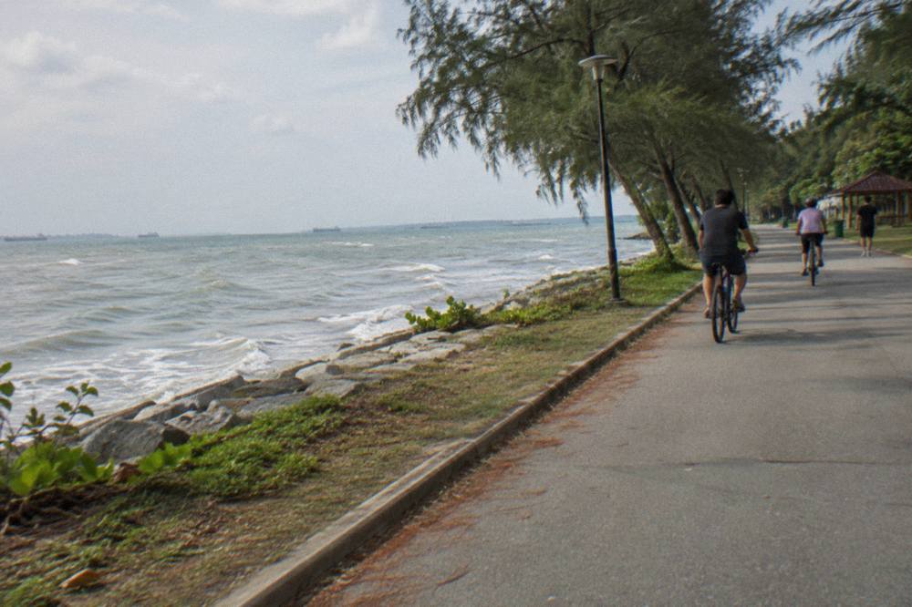
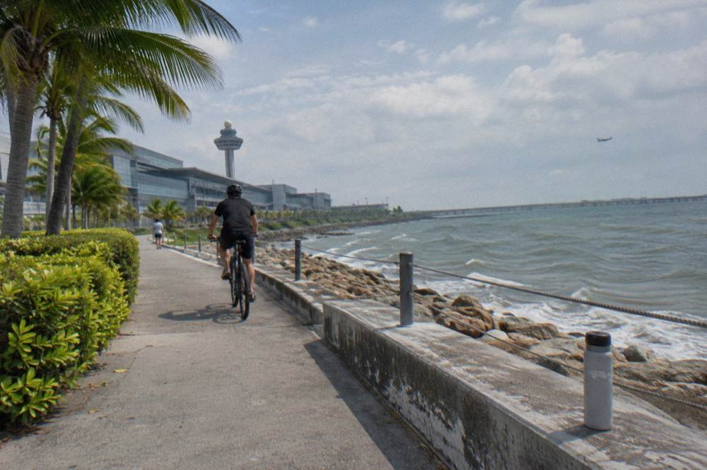
The Changi stretch itself is short by Round Island Route standards, a few kilometres of coast, but it is the part most riders remember. The sea is on one side, the airport fence on the other, and passenger aircraft pass low overhead on approach. On a weekday morning it is one of the quietest rides in the country.
What Is The Changi Bay Coastal Stretch Like To Ride?
The signature piece is Changi Bay: the Round Island Route crosses it on two cycling bridges totalling 140 m, and NParks built a boardwalk and lookout pavilion beside them. Bicycles are allowed on the RIR tracks marked with the cyclist logo, but the story changes at Changi Beach Park, where NParks lists select boardwalks as no-cycling.
The Changi Bay crossing is the reason many riders come east at all. Phase 1 of the Round Island Route, opened on 22 January 2022, includes two purpose-built cycling bridges over the bay, 140 m in total, plus a boardwalk and a lookout pavilion where the route turns along the water. Per NParks' Round Island Route page, bicycles and PMDs are allowed on the RIR tracks carrying the cyclist logo, which this stretch does. The path is wide, concrete and unshaded in stretches, so the pavilion is a welcome shade stop rather than a decoration.
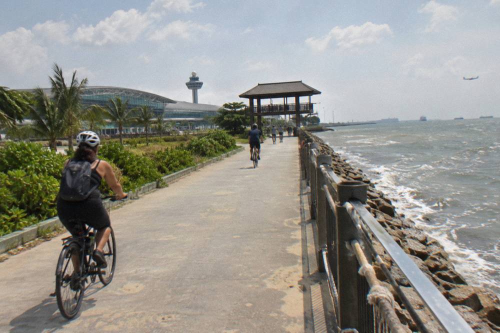
The catch is that bicycles are not welcome everywhere. NParks' own list of places where cycling is not allowed includes select boardwalks at Changi Beach Park, so parts of the beachfront walk are foot traffic only, and riders are expected to dismount and push. Further along the coast toward the ferry terminal, the same logic applies at the mangrove boardwalks at Pasir Ris Park, and out on Pulau Ubin the boardwalk rules are stricter still. The pattern to plan around: red-lined shared path for riding, wooden boardwalk usually for walking.
| Feature | Riding allowed | What to expect |
|---|---|---|
| Round Island Route Changi Bay track | Yes, cyclist logo marked | Wide concrete path, exposed to sun |
| Two cycling bridges at Changi Bay | Yes | 140 m total crossing over the water |
| Boardwalk and lookout pavilion at Changi Bay | Stop and walk as signposted | Shade and a rest point |
| Select boardwalks at Changi Beach Park | No | Dismount and push |
| Changi Beach Park seafront path | Yes, shared path | Give way to pedestrians, 25 km/h cap |
Between the bridges and the beach park sits Jurassic Mile, the landscaped coastal strip near the airport where dinosaur sculptures line the path. It is a public photo stop, and it also appears by name in the itinerary of the guided airport coastline ride described below, which is about the only way a visitor hears about it in advance: it is not on the main tourist maps.
Which Guided Ride Covers The Changi Coastline?
One guided option starts at Changi Airport Terminal 2 and rides the coast directly: the Airport Coastline Ride, 2 Hours by Walk & Wander, from $93 per person, with the bike, a safety briefing, a Jurassic Mile photo stop, a coastal rest stop and a sandwich at the end included. It is a new listing without reviews yet, so there is no rating to lean on.
For a 2-hour loop of this coast with someone else handling the logistics, that ride is the direct match: the meeting point is Changi Airport Terminal 2 itself, which means the tour is a genuine layover-to-bike option. No hotel pickup is included, so the airport start is also the practical start. Because it is a brand-new listing, there is nothing to assess from guest feedback, only what the itinerary promises.
Three guided rides cover the eastern coastline between them, at three very different price points and durations:
| Ride | Duration | From, per person | Meeting point | Reviews |
|---|---|---|---|---|
| Airport Coastline Ride | 2 hours | $93 | Changi Airport Terminal 2 | New listing, none yet |
| 5-Hour Nature Ride | 5 hours | $84.04 | GoCycling @ Punggol Park | 5.0 across 37 reviews |
| River Route via F1 Track | 2 hours | $47 | City Scoot at Esplanade Mall | 14 reviews so far |
The trio above spans the decision: the airport ride for the coast itself, the 5-Hour Nature Ride out of Punggol Park for a longer, small-group format capped at 4 riders, and the 2-hour River Route along the Marina Bay waterfront for the cheapest guided entry point. Full itinerary and booking details for the coastal option are on the Airport Coastline Ride page.
The 5-Hour Nature Ride deserves a sentence of contrast. It starts at GoCycling @ Punggol Park, carries a 5.0 rating across 37 reviews, includes the bike, helmet, bottled water, a free bandana and a poncho if it rains, and caps groups at 4. It does not include lunch or snacks, so the five hours are riding hours. The River Route via F1 Track, meanwhile, is a 2-hour city loop from Esplanade Mall that touches the Marina Bay riverfront and the Formula 1 street circuit route, with 14 reviews so far on its listing and a group cap of 12, from $47 per person with bike, helmet and bottled water included.
Back on the coast, what the airport ride offers that the others do not is simple geography. Terminal 2 sits minutes from Jurassic Mile and the Changi Bay path, so the full 2 hours stay east rather than burning half the slot riding out of the city. Riders booking it should note what is and is not part of the price: bike rental, safety briefing and the end-of-tour sandwich are in, while extras beyond the listed stops are out.
How Do You Start A Pulau Ubin Ride From Changi Point?
Changi Point Ferry Terminal is the mainland launch for Pulau Ubin, the kampong island ten minutes across the water. Guided Ubin rides that start there include the Private Pulau Ubin Ride, from $96.05 per person with a two-way skip-queue island ferry and a coconut refreshment included, and the Ubin Heritage Ride, from $195 with the bumboat and a local meal included. Once you're over on Ubin, the guide to Singapore's mountain bike trails and rentals covers the Ketam Mountain Bike Park and everything you need to ride it.
The ferry terminal is where the east coast ride becomes an island ride. Bumboat specifics such as fares and crossing times are not printed here because they are unverified and change; what is verifiable is which guided tours absorb the crossing into their price, and the differences matter more than the fare itself.
| Ride | Starts at | Ferry included | Meal | From, per person | Reviews |
|---|---|---|---|---|---|
| Private Pulau Ubin Ride | Changi Point Ferry Terminal | Two-way, skip queue | Coconut refreshment | $96.05 | 5.0 across 153 reviews |
| Ubin Heritage Ride | Changi Point Ferry Terminal | Return bumboat | Local meal and drink | $195 | New listing, none yet |
| Pulau Ubin Nature Ride | Pulau Ubin itself | No, ferry not included | No | $84.04 | 4.2 across 29 reviews |
Before you commit to any of these rides, our guide to whether Pulau Ubin deserves a spot on your Singapore itinerary covers what the island actually delivers for the effort.
That third option starts on the island at the operator's own Ubin meeting point, so riders handle the crossing themselves; the first two take the ferry question off your plate. On the island, NParks' Ubin cycling page recommends renting a helmet from the island shops or bringing your own, and signs direct cyclists to dismount and push on the steeper slopes. Ketam Mountain Bike Park, inside the 45 ha park, holds roughly 10 km of trails with three IMBA-rated tracks: Blue Square, Black Diamond and Double Black Diamond.
One caveat shapes any Ubin ride right now. NParks notices list a section of the Coastal Loop boardwalk at Chek Jawa Wetlands as closed for maintenance from 15 September 2026, expected completion 30 April 2027, with the Chek Jawa Wetlands Tour suspended until further notice. None of the guided rides here imply they enter the closed boardwalk section, and a rider should not plan on it either; the Pulau Ubin cycling guide covers the open parts of the island in detail, and the details for the ferry-side option are on the Private Pulau Ubin Ride page.
What Cycling Rules Apply Around Changi And On Singapore Roads?
The numbers to remember are 25 km/h on cycling and shared paths, 10 km/h on footpaths, and no bicycles at all on Pedestrian-Only Paths, in force since 1 July 2025. A helmet is mandatory on roads, on-road groups are limited to five riders in single file, and riding on a Pedestrian-Only Path carries penalties of up to $2,000 and/or three months for a first offence.
These are national rules, but they bite hardest on the east coast because the path types change constantly: one moment you are on a wide shared path, the next on a narrow footpath beside a bus stop. LTA's code of conduct sets the baseline for all of them, and the current LTA device rules summary maps each path type to its speed cap.
| Path type | Marking | Bicycle allowed | Speed limit |
|---|---|---|---|
| Cycling path | Red or dark grey, cyclist logo | Yes | 25 km/h |
| Shared path | Cyclist and pedestrian logos | Yes | 25 km/h |
| Footpath | Unmarked, beside roads and in estates | Yes, 10 km/h | 10 km/h |
| Pedestrian-Only Path | Beside a cycling path, pedestrian signage | No, since 1 July 2025 | Not applicable |
| Road | Standard road, no expressways or tunnels | Yes, helmet mandatory | Road speed limit |
Two on-road details matter to east-side riders specifically. LTA maintains Sunday bicycle lanes along Tanah Merah Coast Road and West Camp Road from 5am to 11am, and on those stretches the five-rider group limit does not apply, which is why serious road riders gather there on Sunday mornings. Separately, the Seletar Sunday Cycling Lane was announced in October 2026 as extending from 4.6 km to 11.2 km along Seletar Aerospace Drive and Punggol Barat Drive, with works starting in November 2026 and the full length operational by Q1 2027; that is a future north-east option rather than something bookable today.
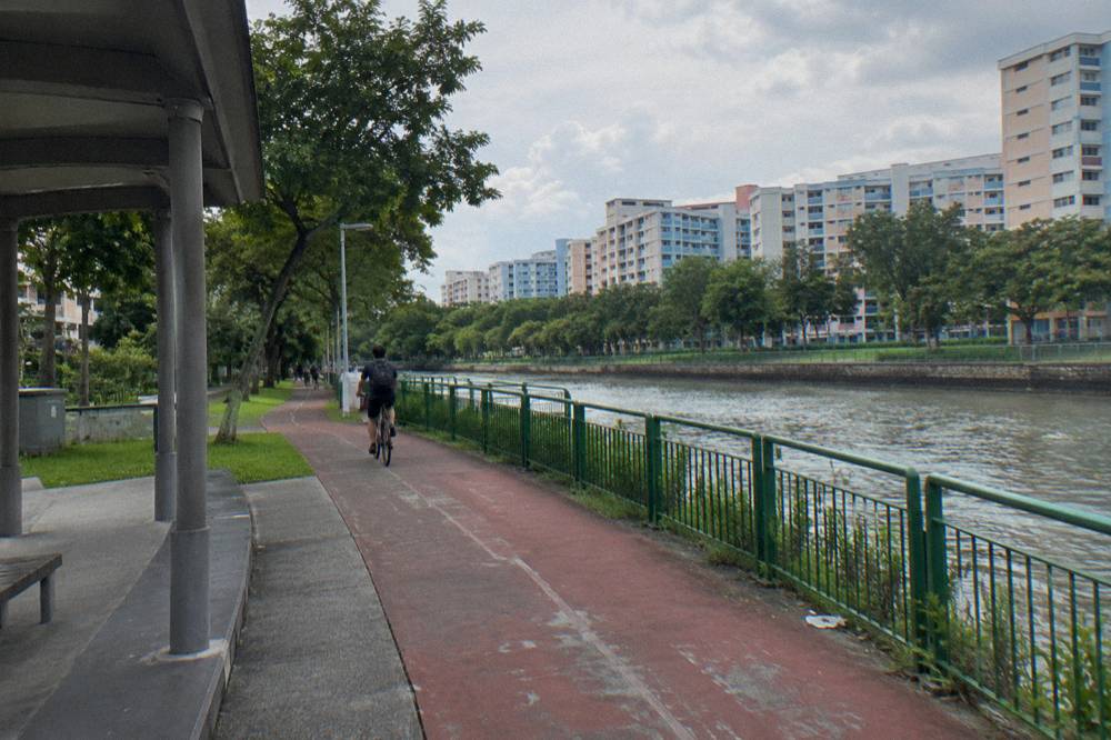
The Pedestrian-Only Path rule deserves one plain sentence of caution: since 1 July 2025, footpaths sitting next to dedicated cycling paths in areas like Tampines, Punggol and Sengkang have been converted to pedestrian-only, and enforcement by LTA officers began the same day. The up to $2,000 and/or three months figure applies to that specific offence, and LTA describes its approach as measured except toward riders who speed or ride recklessly. On a self-guided east coast ride, the safe habit is simple: when a footpath runs beside a red cycling path, take the cycling path.
When Is The Best Season To Cycle Around Changi?
On Meteorological Service Singapore's 1991 to 2020 Changi normals, February is the driest month at 105.1 mm of rain across 8.5 rain days, while November and December are the wettest at 252.3 mm and 331.9 mm. The wettest period runs from November to January, which makes February to March, and again June to August, the more reliable windows.
- Up to 2 hours4 tours
- 3 to 4 hours17 tours
- 5 to 6 hours1 tour
- 7 hours or more1 tour
The east coast is as exposed to the weather as it is to the sea, so timing matters more here than on a sheltered city loop. The same Changi climate station that records the island's normals sits a few hundred metres from the route: May is the hottest month with a 24-hour mean of 28.6 C, and the annual mean relative humidity sits at 82 percent, with about 171 rain days across a typical year and 2113 mm of rainfall in total.
| Month | Mean temp | Rainfall | Rain days | Sunshine hours per day |
|---|---|---|---|---|
| February | 27.3 C | 105.1 mm | 8.5 | 7.0 |
| May | 28.6 C | 164.3 mm | 14.5 | 6.0 |
| October | 27.9 C | 168.3 mm | 15.0 | 5.0 |
| November | 27.2 C | 252.3 mm | 19.0 | 4.4 |
| December | 26.8 C | 331.9 mm | 19.3 | 4.3 |
Source: Meteorological Service Singapore 1991 to 2020 normals for Changi, published at the national climate pages. What the table says in practice: a November or December ride along Changi Bay is a coin toss on daylight and a probability on rain, while a February ride is close to a sure thing.
Guided Rides Covering The Changi Coast, By Price
Per-person starting prices for the three guided options listed
The other lever is the time of day. Guided rides in the east lean early: the Sunrise Ride, Local Breakfast, a 3 to 4 hour small-group ride from Punggol Field capped at 5 riders, runs the first-light hours and folds breakfast into the price, from $48.02 per person, with 3 reviews so far on its listing. The best time to cycle in Singapore works through the month-by-month trade-offs for the whole island if you want the deeper cut.
What Should You Pack For A Changi Coastal Ride?
Pack for sun and sudden rain more than for distance: a helmet, front white and rear red lights if you will ride past dusk, a poncho, more water than feels necessary, and sun protection. Guided listings on this coast include bottled water and disposable ponchos as standard, helmets appear on most but are request-ahead on a couple, so check the inclusion list before assuming.
The Changi coast is short on shade and long on exposure. On-road helmet rules do not apply on the park connectors, but NParks advises a helmet on park connector rides anyway, and every guided option listed here either includes one or asks riders to request one in advance. Heat is the other constant: local advisories in early November 2026 reported daily maxima of 33 to 35 C on some days, and the airport-side paths hold that heat in the concrete.
| Item | Why it matters here | Tour listings |
|---|---|---|
| Helmet | Mandatory on roads, advised on park connectors | Included on most rides, request ahead on some |
| Water | Exposed path, 33 C and above on hot days | Bottled water included on nearly all |
| Poncho | Afternoon showers, November to January worst | Disposable poncho included on several rides |
| Lights, front white, rear red | Required riding at night | Bring your own |
| Sun protection | Minimal shade along the bay and beach park | Bring your own |
Two practical notes round out the packing list. First, storage: several city-side operators offer bag storage at the shop during the ride, but the airport and Changi Point rides start at public meeting points, so plan to carry what you bring or use the airport's own facilities. Second, food: the beach park hawker scene is the classic post-ride stop, and riders who want the food folded into the ticket itself can look at the food-included rides that start further west, such as the Katong Food Ride from $96.05 or the full-day private ride with lunch, both covered in the site's food tour roundups.
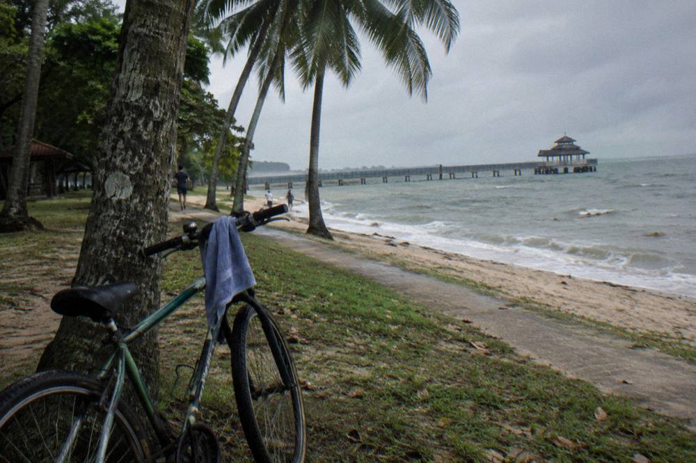
For riders assembling the day themselves, the honest summary is that the east rewards preparation but forgives inexperience. The paths are flat, wide and signed. The rules are published. The ferries run on their own schedule. The only real mistake available is turning up in November without a poncho, or assuming the Chek Jawa boardwalk will be open.
Common Questions About Changi Cycling
Where Can You Cycle Around Changi In Singapore?
Ride the Round Island Route's Changi Bay track, the shared paths through Changi Beach Park, and the park connectors arriving from Pasir Ris, Tampines and Punggol. NParks lists Changi Beach Park carpark 7 as a Round Island Route access point, and bicycles are welcome on every track marked with the cyclist logo.
Can You Cycle On The Changi Beach Park Boardwalks?
Only some of them. NParks lists select boardwalks at Changi Beach Park as no-cycling zones where riders must dismount and push, while the seafront shared path and the Round Island Route track beside it are open to bicycles with a 25 km/h speed cap.
How Do You Get To Pulau Ubin With A Bike From Changi?
Cross from Changi Point Ferry Terminal. Guided options that bundle the crossing include the Private Pulau Ubin Ride from $96.05 with a two-way skip-queue ferry and the Ubin Heritage Ride from $195 with the return bumboat and a local meal; the self-guided rider takes the public bumboat, whose fare is set at the terminal.
What Speed Limit Applies On Singapore Cycling Paths?
25 km/h applies on cycling paths and shared paths, and 10 km/h on footpaths, per LTA's device rules. On roads a helmet is mandatory and the road's own speed limit applies. Since 1 July 2025, bicycles are not allowed at all on footpaths converted to Pedestrian-Only Paths, with penalties up to $2,000 and/or three months for a first offence.
Which Guided Ride Starts At Changi Airport?
The Airport Coastline Ride, 2 Hours by Walk & Wander, starts at Changi Airport Terminal 2, from $93 per person, and includes the bike, a safety briefing, a Jurassic Mile photo stop, a coastal rest stop and a sandwich at the end. It is a new listing with no reviews yet, and no hotel pickup is included.
Is Cycling In Changai Safe For Beginners?
Yes, the east is the gentlest corner of the island for new riders: the paths are flat, wide and mostly segregated from traffic, and the biggest hazards are sun exposure and sudden rain rather than cars. Follow the shared-path etiquette of giving way to pedestrians, dismount at no-riding signs, and carry water, and the round trip is well within a casual rider's range.