Singapore Cycling Routes: Rides By Distance And Scenery
Singapore packs an island-wide network of park connectors, a 75 km phase of the Round Island Route, coastal loops and a car-lite island into a very small space. Here is how the main routes compare by distance and scenery, and where a guided tour takes over the planning.
Short answer
The headline routes are the Round Island Route Phase 1 at 75 km, the Central Urban Loop at 36 km, the North Eastern Riverine Loop at 26 km and roughly 12 km of Sentosa cycling trails, all stitched together by over 350 km of park connectors. Guided rides cover the same ground in 2 to 8 hours, from $47 to $224.11 per person depending on length and group size.
Singapore routes its cycling the way it routes everything else: deliberately, and with a surprising amount of green for a city this dense. The island carries over 350 km of park connectors by NParks' own count, a dedicated long-distance project in the Round Island Route, coastal paths at East Coast Park and Changi, a riverine network around Punggol and Kallang, and a village island in Pulau Ubin where the cycling is gravel and the pace is kampong. The question is rarely whether you can ride somewhere. It is which somewhere suits the time, the legs and the scenery you have in mind. And since a ride here rarely feels complete without a meal stop, our guide to hawker centre food rides you can cycle between covers how to pair the routes with the food.
This guide breaks the options down by distance and scenery, then shows where a guided ride covers the same ground. The tour prices, durations and group sizes below come straight from each operator's booking page, and every distance given is one that an official source states. If you came here asking which single stretch is the nicest, the companion piece on where to cycle in Singapore takes that question head on.
What Are The Main Singapore Cycling Routes?
The backbone is the Round Island Route, whose opened Phase 1 runs 75 km from Rower's Bay in the north-east past the Singapore River to Berlayer Creek in the south, inside a planned continuous 150 km corridor that NParks describes as part of a 360 km island-wide network. Around it sit named loops, coastal riding at East Coast Park and Changi, the Rail Corridor and rustic trails on Pulau Ubin.
The Round Island Route matters because it is built as one continuous line rather than a set of disconnected segments. Phase 1 opened on 22 January 2022 and covers the eastern half of the island, linking Rower's Bay, Sengkang Riverside Park, Pasir Ris Park, Changi Beach Park and East Coast Park on the way south. Two cycling bridges at Changi Bay, 140 m of span in total, carry the route over the water where a road used to force a detour, and NParks notes that bicycles and PMDs are allowed wherever the track carries the cyclist logo. The full route is planned as a continuous 150 km.
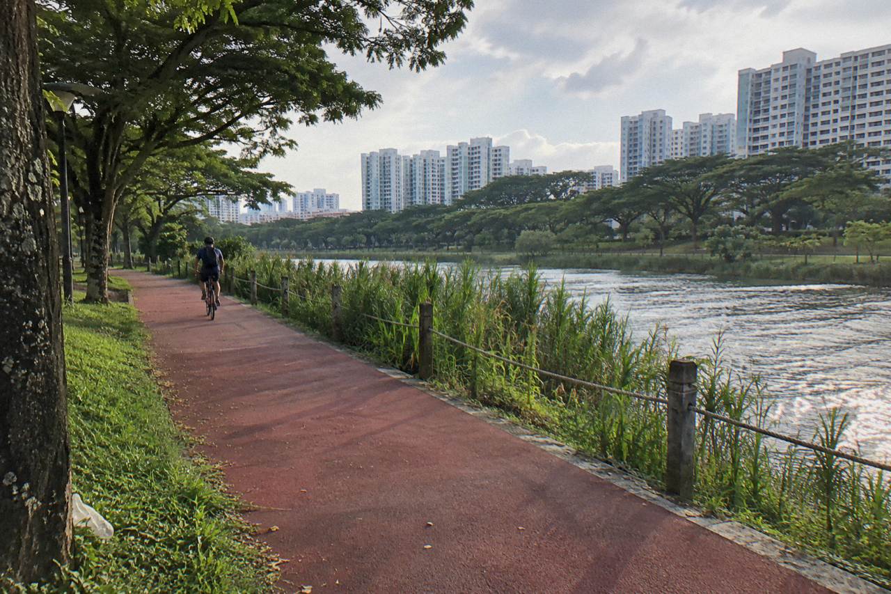
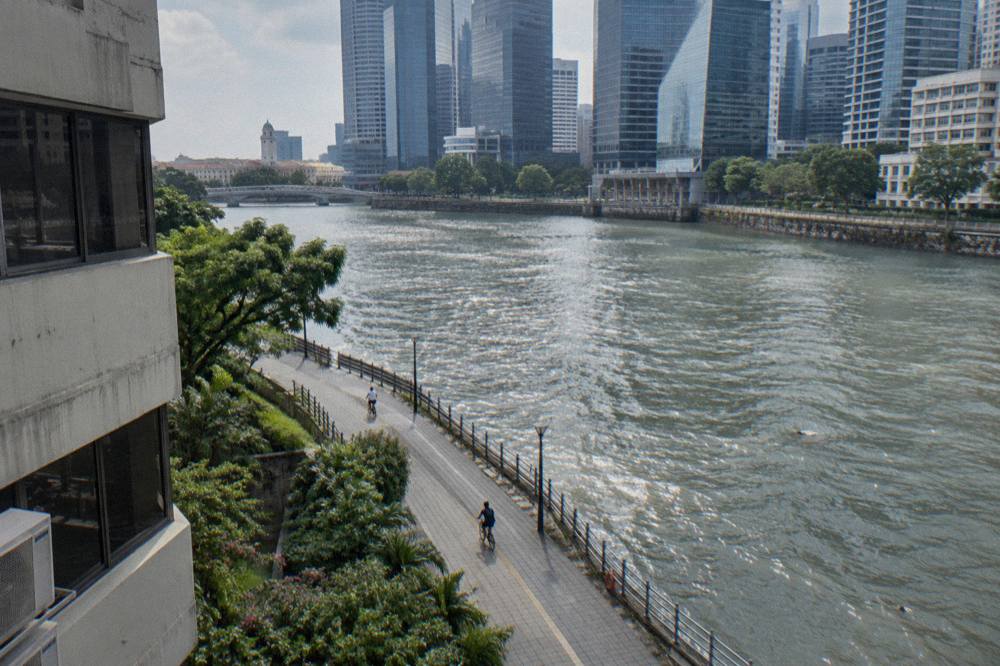
The loops branch off that spine. The Eastern Coastal Loop links Pasir Ris down to East Coast Park along the shore; the Central Urban Loop threads 36 km through the city's parks and waterways; the North Eastern Riverine Loop runs 26 km around the reservoirs and river mouths of the north-east. Each has its own character, from the open sea views of the east to the shadier, slower river sections further inland. For a full breakdown of the connector network itself, see the Singapore park connector network guide.
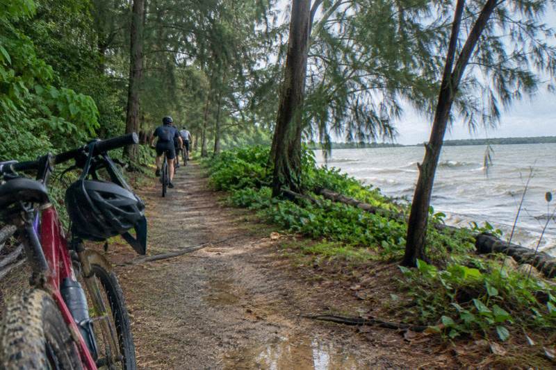
Then there is Pulau Ubin, which is a different proposition entirely. The island holds the 45 ha Ketam Mountain Bike Park with about 10 km of IMBA-rated trails in three grades, plus village roads and gravel paths that feel a world away from the mainland. The Pulau Ubin cycling guide covers it in detail.
| Route | Distance | Scenery |
|---|---|---|
| Round Island Route, Phase 1 | 75 km, Rower's Bay to Berlayer Creek | Reservoirs, rivers, coast, two cycling bridges at Changi Bay |
| Central Urban Loop | 36 km | City parks, waterways, town-edge greenery |
| North Eastern Riverine Loop | 26 km | Riverside and reservoir paths around Punggol and Sengkang |
| Sentosa cycling trails | About 12 km | Coastal and beach trails, long or steep slopes on some guide trails |
| Ketam Mountain Bike Park, Pulau Ubin | About 10 km of trails | Rustic jungle, gravel and dirt, IMBA-rated tracks |
| Rail Corridor | Length varies by segment | Former railway line, green corridor through the centre of the island |
| Marina Bay waterfront | Short waterfront loop | Skyline, Gardens by the Bay fringe, river and bay promenades |
For planning longer rides, NParks' own cycling pages put the park connector network at over 350 km.
Which Routes Work For A Two To Three Hour Ride?
A short ride here is usually a stretch of one loop or a waterfront circuit around Marina Bay and the Singapore River. Two to three hours at a tourist pace covers the Marina Bay loop with time to stop, a section of the Eastern Coastal Loop, or a guided night circuit of the bay, which is exactly how long the shortest guided rides run.
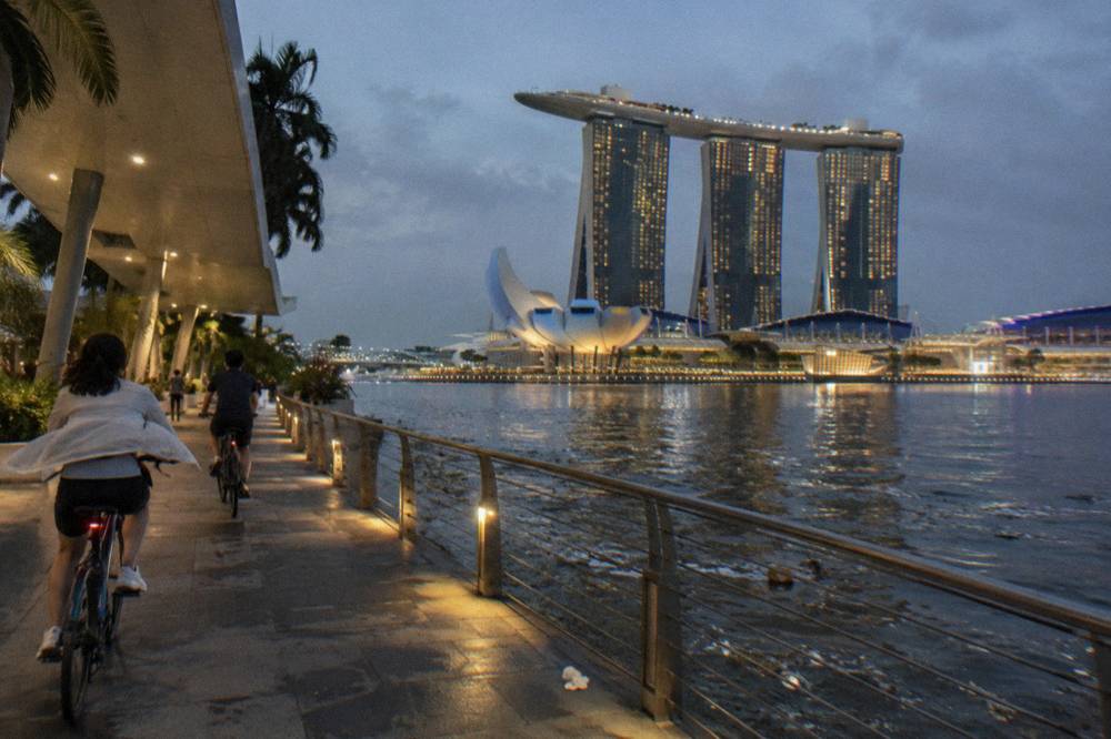
The waterfront route through Marina Bay, the Singapore River and the Gardens by the Bay fringe is the classic short ride. It is flat, almost entirely off-road, and the scenery changes every few hundred metres: shophouses, then the financial district, then Supertrees. Because it is central and well lit, it also works after dark, which is why the night-cycling format has taken hold here. The Marina Bay cycling guide maps the stops.
East Coast Park offers the other easy answer. The park sits on the coast with a long shared path along the beach, and it doubles as an access point for the Round Island Route at Areas H and A. A leisurely out-and-back along a stretch of the beach path fits comfortably inside two hours, with food kiosks along the way. The East Coast Park cycling guide has the detail.
If a short ride still sounds like work, the guided versions compress it further.
The 4 hour city rides cover the heritage district and waterfront with a licensed guide, the 2 hour Marina Bay night ride compresses the skyline into an evening, and the price spread across them reflects duration and privacy rather than scenery.
For a short ride with a guide's local knowledge, the River Route via F1 Track runs 2 hours from Esplanade Mall with a licensed guide, from $47 per person, in groups of up to 12, with bike, helmet and bottled water included. Fourteen reviews sit on the booking page, all at the top rating. The route hugs the river and uses the Formula 1 street circuit, which is a strange thrill: riding a grand prix track at a touring pace with a guide explaining which corner is which.
How Long Is The Round Island Route And Can You Ride It In A Day?
Phase 1 of the Round Island Route is 75 km from Rower's Bay to Berlayer Creek, and yes, it is rideable in a day for anyone comfortable with that distance, since the path is nearly flat and largely separated from traffic. Casual riders treat it as a two-day project split at Pasir Ris or Changi, and there is no rule against riding only a slice of it and exiting at any of the listed access points.
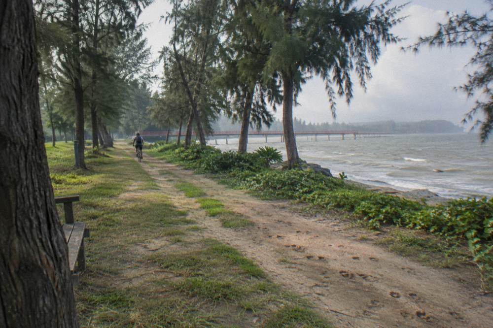
The route's design makes the distance honest work but not technical work. It runs on park connector tracks and dedicated paths almost throughout, passing through Sengkang Riverside Park, Pasir Ris Park, Changi Beach Park and East Coast Park, with the two Changi Bay cycling bridges eliminating the old road gaps. NParks lists formal access points including Pasir Ris Park toilet A2, Changi Beach Park carpark 7, East Coast Park Areas H and A, and Berlayer Creek at the Alexandra Road junction with Telok Blangah Road. Because the access points are spaced along the line, riding half of it and taking the MRT back is a legitimate plan; the bike on the MRT guide explains the folding-bike rules if you go that way.
- Jan222 mm
- Feb105 mm
- Mar152 mm
- Apr164 mm
- May164 mm
- Jun135 mm
- Jul147 mm
- Aug147 mm
- Sep125 mm
- Oct168 mm
- Nov252 mm
- Dec332 mm
Rain-days run from 8.5 (driest month) to 19.3 (wettest month).
Weather is the real constraint. A 75 km day in Singapore means the better part of a day in the saddle with the sun overhead, and the wettest months of the year, November to January, average 252.3 mm of rain in November and 331.9 mm in December, with 19 or more rain days each. The best time to cycle in Singapore guide breaks the calendar down month by month. Riders who want the same east-coast scenery without the distance usually take the Eastern Coastal Loop instead, which covers the coastal character in a shorter, looped course.
| Round Island Route Phase 1, key facts | Figure |
|---|---|
| Distance | 75 km, eastern half of the island |
| Endpoints | Rower's Bay, north-east, to Berlayer Creek, south |
| Launched | 22 January 2022 |
| Notable structures | Two cycling bridges at Changi Bay, 140 m total span |
| Signature parks passed | Rower's Bay, Sengkang Riverside, Pasir Ris, Changi Beach, East Coast Park |
| Access points listed by NParks | Pasir Ris Park toilet A2; Changi Beach Park carpark 7; East Coast Park Areas H and A; Berlayer Creek at Alexandra Road |
| Full planned route | 150 km, part of a 360 km island-wide network |
Singapore Cycling Routes By Distance
Distances of the main named routes and trails on the island
For contrast, the Rail Corridor and Pulau Ubin are the two routes that trade distance for texture. The Rail Corridor runs on the former railway land through the centre of the island, and a 4 hour guided ride from King Albert Park covers the Rail Corridor and Civic District with coffee or tea and a licensed guide on a Brompton folder, from $96.05 per person in groups of up to 10, with 14 reviews recorded on the booking page. On Ubin, the guided rides start at the operator's meeting point or Changi Point Ferry Terminal depending on the tour.
Which Guided Tours Cover These Routes?
Most guided rides map onto the routes above: 2 to 4 hour city and bay tours covering the Marina Bay and heritage stretches, 4 hour nature rides into the north-east riverine country, food-focused versions, and 4 hour Ubin packages with the ferry crossing arranged. Prices run from $47 to $224.11 per person depending on duration, group size and inclusions, and the most reviewed ride carries 6,579 reviews at a 5.0 average.
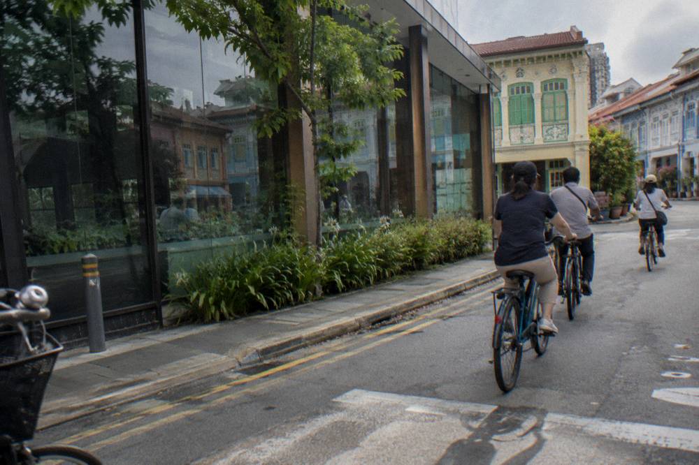
The mapping is not exact, and that is the point. A guided ride takes a route you could ride yourself and adds the things the route cannot supply: a licensed guide who knows which kopitiam is worth the stop, a bike that arrives fitted, and a group size that keeps the pace human. The trade is money and schedule, and the comparison below shows the spread. The private versus group bike tour guide works through that trade in detail.
| Guided ride | Route character | Duration | Group max | From, per person | Reviews |
|---|---|---|---|---|---|
| Licensed Guide, Poncho Included | City and heritage district | 4 hours | 12 | $68.03 | 5.0 across 6,579 reviews |
| Full-Sized Bikes, Small Group | City highlights, one snack and drink | 4 hours | 15 | $64.03 | 5.0 across 1,559 reviews |
| Marina Bay Night Ride | Bay and skyline after dark | 2 hours | 15 | $48.02 | 4.9 across 598 reviews |
| Small Group, Max 10 Guests | Esplanade and civic district | 4 hours | 10 | $64.03 | 4.8 across 74 reviews |
| 5-Hour Nature Ride | Punggol and Coney Island country | 5 hours | 4 | $84.04 | 5.0 across 37 reviews |
| Katong Food Ride, Meal Included | East coast shophouses and food | 4 hours | 8 | $96.05 | 5.0 across 337 reviews |
Two entries deserve a closer look. The most reviewed 4 hour city ride, run under the Licensed Guide, Poncho Included name, starts from $68.03 per person with the bike, a licensed local guide and a poncho included, in groups of up to 12, and rain or shine is the stated policy. Bag storage is available on request by email in advance. The 5-Hour Nature Ride is the outlier on character: it starts at GoCycling at Punggol Park, keeps the group at four or fewer, and heads out past the concrete into the north-east's parks and coast, with helmet, bandana and bottled water included, from $84.04. Snacks and lunch are not.
The Private City Ride, 4 Hours from HR Assist takes the same idea up a level: from $160.08 per person with the total depending on group size, a private tour (guide not itemised on the listing) with a route shaped around your stops, bottled water and poncho included, alcohol excluded. The Full-Day Private Ride from Singapore City Explorers goes further still: 7 to 8 hours with food tastings and lunch built in, from $224.11 per person, 9 reviews recorded on the booking page.
If you would rather ride a route than buy one, the table still tells you where to point the wheels. A 4 hour ride at tourist pace covers a good slice of the connector network: most of the Central Urban Loop, or a strong section of the Eastern Coastal Loop. See the Singapore cycling tour overview for the full landscape of guided formats.
What Rules Apply On The Paths And Roads?
The speed limits are 25 km/h on cycling paths and shared paths, 10 km/h on footpaths, and bicycles are banned entirely on footpaths converted to Pedestrian-Only Paths, where a first offence carries up to $2,000 and/or three months in prison under the enforcement regime that began on 1 July 2025. Helmets are mandatory on roads. Groups on roads are capped at five bicycles in single file, with the limit lifted on the Sunday cycling lanes.
- Small group13 of 23
- Private5 of 23
- Group type not stated5 of 23
The path system is colour-coded, and reading it correctly is the difference between a pleasant ride and a summons. Cycling paths are marked in red or dark grey with the cyclist logo and carry a 25 km/h limit; shared paths carry the cyclist and pedestrian logos together at the same limit; footpaths, the unmarked paths beside roads and inside housing estates, are 10 km/h and now closed to bikes wherever they sit next to a dedicated cycling path and carry Pedestrian-Only markings. The official summary is on LTA's rules and code of conduct page, and the path-type breakdown appears in LTA's where-devices-are-allowed sheet.
| Path type | Marking | Bicycle limit |
|---|---|---|
| Cycling path | Red or dark grey, cyclist logo | 25 km/h |
| Shared path | Cyclist and pedestrian logos | 25 km/h |
| Footpath | Unmarked path beside roads and in housing estates | 10 km/h |
| Pedestrian-Only Path | Pedestrian logos beside a cycling path | Bicycles prohibited |
| Road | Excluding expressways and tunnels | Road speed limit, helmet mandatory |
The Pedestrian-Only Path regime is the newest trap for visitors, because the converted footpaths look like ordinary footpaths until you read the markings. The conversion applied to over 200 km of paths in areas including Tampines, Punggol, Sengkang, Yishun and Clementi. LTA's enforcement officers began issuing penalties on 1 July 2025 after an education period, and the stated approach is measured for genuine confusion but zero tolerance for speed or reckless riding. A rider visiting in 2026 and sticking to cycling paths and park connectors will not meet one, but a rider improvising a shortcut beside a cycling path might.
Inside the parks, the etiquette is gentler but still codified. NParks' path-type guide describes the attention zones: red dotted lines near bus stops, crossings, playgrounds and fitness corners, where cyclists are expected to slow and give way. The advice that matters most in practice is to keep left, ring or call before passing, and dismount where signs say so. The cycling rules for visitors guide collects all of it in one place, and the night cycling guide covers the after-dark lighting rules, front white and rear red, which apply to every rider on a public path.
A closing note on closures, because routes move. NParks notices list a section of the Tampines Park Connector closed for construction, stretches of the Bedok Park Connector closed for MRT works expected to finish in the final quarter of 2026, and Punggol Point Park closed from 11 August 2026 with completion expected on 31 December 2027. None of these breaks the Round Island Route, but each affects a loop worth knowing about.
When Is The Best Time To Ride These Routes?
By the climate record, February is the driest month with 105.1 mm of rain over 8.5 rain days, March is the next driest, and April sits around the yearly average, while November to January is the wettest stretch of the year, so late February into March offers the best balance of dry paths and bearable heat. May is the hottest month at a 28.6 C 24-hour mean, and the November monsoon onset makes late-year riding a rain-management exercise rather than a washout.
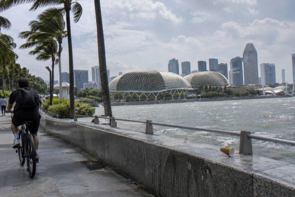
The figures come from the Meteorological Service Singapore 1991 to 2020 normals for Changi, and they are remarkably flat by the standards of anywhere else: mean monthly temperatures run from 26.8 C in December and January to 28.6 C in May, and the daily maxima stay within a narrow band in the low thirties Celsius all year. What changes month to month is water. Rainfall varies sharply between February, the driest month, and December, the wettest, and rain days climb from 8.5 to 19.3. Humidity holds near 82 percent across the year, which is why the heat reads harder than the thermometer suggests.
| Month | Mean temp C | Rainfall mm | Rain days | Sunshine h/day |
|---|---|---|---|---|
| February | 27.3 | 105.1 | 8.5 | 7.0 |
| March | 27.8 | 151.7 | 12.1 | 6.3 |
| April | 28.2 | 164.3 | 14.9 | 6.1 |
| May | 28.6 | 164.3 | 14.5 | 6.0 |
| September | 28.0 | 124.9 | 12.5 | 5.4 |
| November | 27.2 | 252.3 | 19.0 | 4.4 |
| December | 26.8 | 331.9 | 19.3 | 4.3 |
The practical reading is about the day, not the month. Singapore's rain tends to arrive in bursts rather than settle in for the afternoon, and the sunrise guided rides are timed for the cooler, clearer morning hours. A 3 to 4 hour sunrise ride from Punggol Field, from $48.02 per person with breakfast included and groups capped at five, puts the riding in the gentlest hours the island offers. Three reviews sit on the booking page, all top marks. For clothing and gear, the what to wear cycling in Singapore guide is the companion. If you want the fuller picture of how guided rides work before committing, the Singapore cycling tour guide with routes and pricing covers what to expect.
- Up to 2 hours4 tours
- 3 to 4 hours17 tours
- 5 to 6 hours1 tour
- 7 hours or more1 tour
Haze is the wildcard that the temperature table does not show. Slight to moderate haze is common in the Southwest Monsoon months of June to September and in the light-wind inter-monsoon windows, and severe transboundary episodes can drop visibility sharply. The Northeast Monsoon season, by contrast, tends to suppress haze while delivering rain, which is the trade the island makes every year.
Common Questions About Singapore Cycling Routes
What Is The Longest Dedicated Cycling Route In Singapore?
The Round Island Route is the longest dedicated project: Phase 1 runs 75 km from Rower's Bay to Berlayer Creek across the eastern half of the island, and the full planned route is 150 km inside a 360 km island-wide recreational network. It is rideable in a day by a fit cyclist on nearly flat, traffic-separated paths.
Can You Cycle Between The Main Sights Without Riding On Roads?
Largely, yes. The Marina Bay and Singapore River waterfronts, the Gardens by the Bay fringe and the civic district are connected by shared and cycling paths, and the park connector network links the major parks island-wide. The main exceptions are short gaps and any footpath converted to a Pedestrian-Only Path, where bicycles are prohibited.
How Many Km Of Cycling Paths Does Singapore Have?
NParks counts over 350 km of park connectors, plus the named loops and the Round Island Route, whose opened Phase 1 adds 75 km.
What Is The Speed Limit For Bicycles On Singapore Cycling Routes?
25 km/h on cycling paths and shared paths, and 10 km/h on footpaths, per the Active Mobility Regulations. Bicycles are not permitted at all on Pedestrian-Only Paths, and riding on one carries up to $2,000 and/or three months for a first offence.
Is There A Guided Tour That Covers The Best Cycling Routes?
Yes. The guided rides here map the city, bay, riverside and nature routes into 2 to 8 hour formats, from $47 per person for a 2 hour river circuit to $224.11 for a full-day private ride with food. The most reviewed option, a 4 hour city tour from $68.03, holds a 5.0 average across 6,579 reviews.
Which Month Is Best For Cycling In Singapore?
February is the pick on the climate record: the driest month with 105.1 mm of rain over 8.5 rain days, 7 hours of daily sunshine and a 27.3 C mean. March is next driest; April is about average. November and December are the wettest and least sunny, and worth avoiding for distance goals.
Whatever route you settle on, the booking decision is usually simpler than the route decision. A guided ride trades flexibility for a guide who handles the path rules, the bike and the stops, and every tour named on this page carries free cancellation. The question of which of those rides suits you is exactly what Singapore Bike Tours exists to answer. Before you commit to a route, it helps to know whether the city itself is rider friendly, and our plain answer on Singapore as a cycling city covers the paths, the rules and the weather in one read.