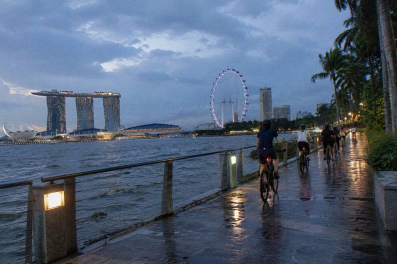
Kallang Park Connector: Cycling From The City To The Water
The Kallang Park Connector is one of the most useful riding corridors in Singapore: it starts within walking distance of the city centre and runs along the Kallang Basin to the coast.
Short answer
The Kallang Park Connector is a riverside cycling route that runs from the city edge along the Kallang River and Basin toward the East Coast. Guided tours that use the corridor cost from $47 to $104.05 per person, run 2 to 5 hours, and all use regular bicycles. Expect shared paths with a 25 km/h limit, and give way to pedestrians.
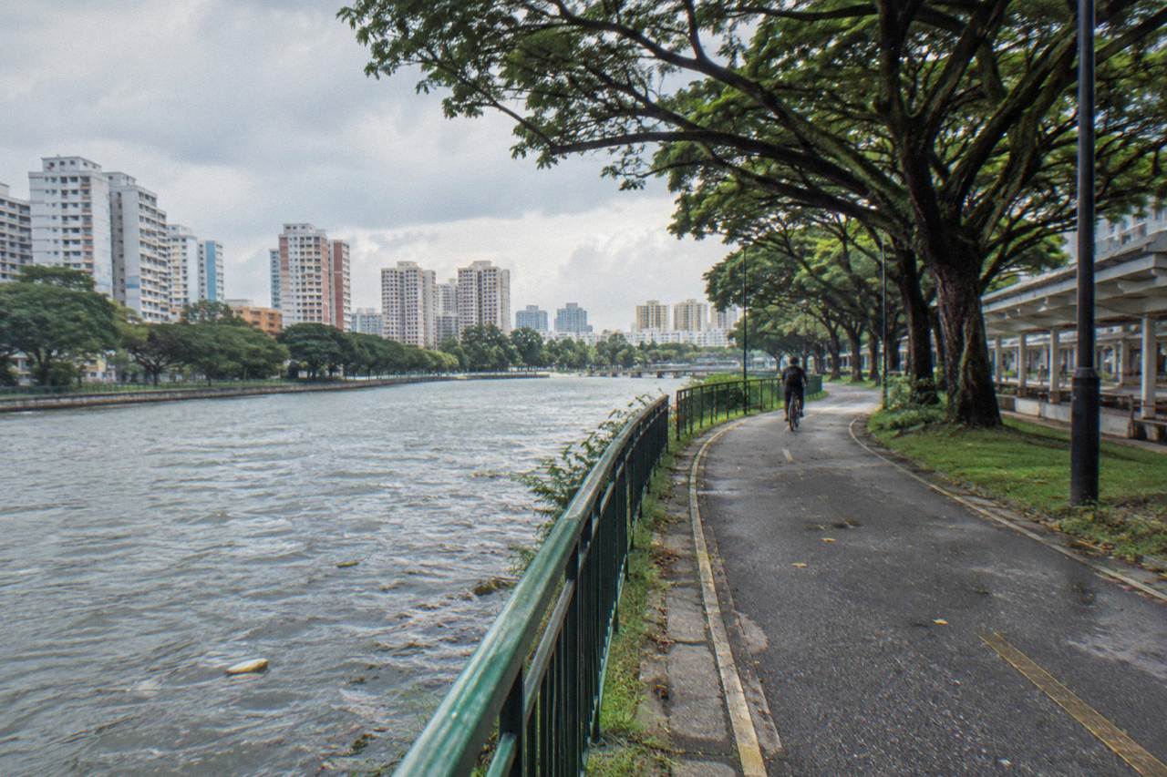
The Kallang River is the longest river in Singapore, and the park connector that follows it is one of the most direct ways to ride out of the city without ever sharing a lane with a bus. The corridor links the dense centre of the island to the Kallang Basin, the stadium district and, for riders who keep going, the coastal park network to the east. It is a working commuter route on weekday mornings and a leisure corridor the rest of the time.
This page walks through what the connector actually is, which route choices exist along it, what guided rides along the same river cost, and the path rules that apply once you are on it. The tours covered here all ride regular, non-electric bicycles, which suits the flat terrain of the river corridor well.
What Is The Kallang Park Connector?
The Kallang Park Connector is a riverside cycling corridor that follows the Kallang River from the edge of the city centre out to the Kallang Basin and its surrounding parkland. It forms part of Singapore's island-wide park connector network, which NParks describes as more than 350 km of linked green trails. It is a shared path, ridden at a maximum of 25 km/h, and it connects to further coastal routes toward the east.
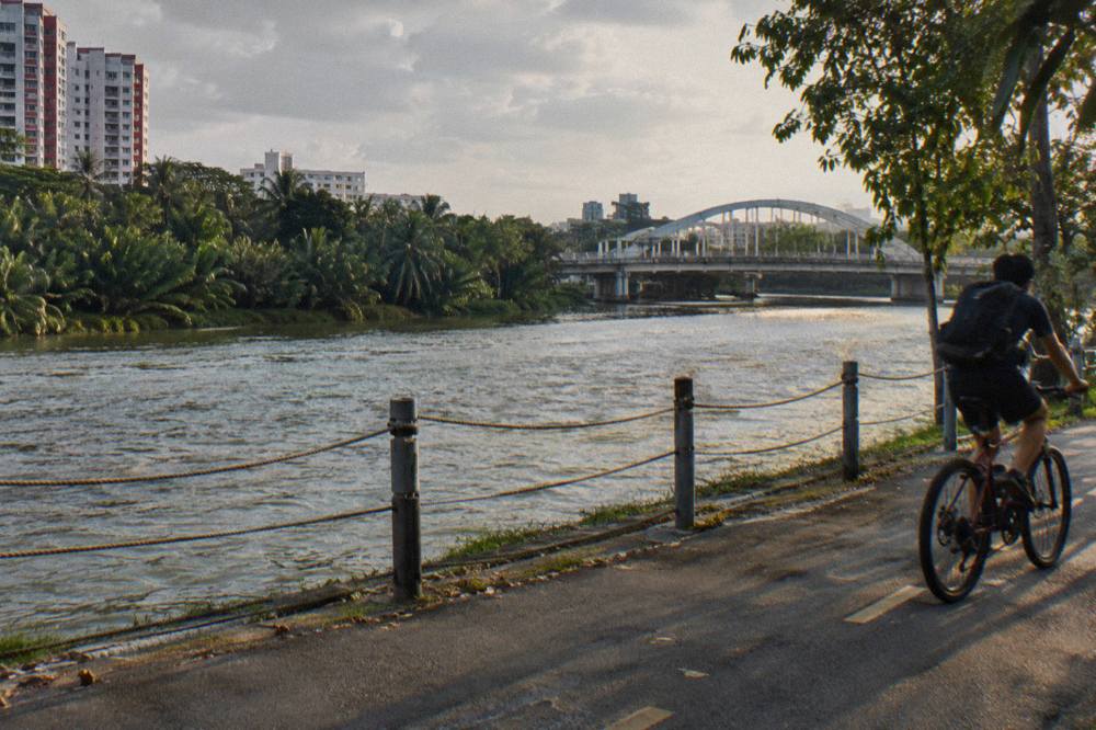
The connector is a piece of infrastructure, not a single named linear park. It threads through the Kallang area: past the river mouth near the Merdeka Bridge end, along the Basin where rowing crews train, and past the stadium precinct that was built around the old National Stadium site. The geography is simple. The city is to the west and south, the basin is in the middle, and the coast is east.
What makes it useful for a visitor is the start. Several guided rides in Singapore begin at meeting points in the Esplanade and City Hall area, which sits close to the city end of the river corridor. A rider who starts there can reach open water within a few kilometres, almost entirely on paths rather than roads.
The connector is one strand of a much larger network. NParks describes the Park Connector Network as linking parks, rivers and nature areas island-wide, and the Kallang River is one of the main arteries of that system. The broader planning context, including how the connector relates to the round island route, matters for riders deciding how far to go in one outing.
Where Does The Kallang Park Connector Start And End?
Riders generally treat the connector as running from the Kallang River mouth near the Merdeka Bridge and city edge, along the river and Basin, to the stadium district and onward connections toward the coast. It is not a fenced point-to-point trail with a gate at each end. The practical start for most visitors is the city-side end, reached from Esplanade or City Hall on short connecting paths.
The city end is the one that matters to a tourist, because it is walkable from the hotels and offices of the central district. The Marina Bay cycling guide covers the adjacent waterfront loop, and the two areas connect: a rider doing the Bay loop can peel off toward the river and follow the water north-east.
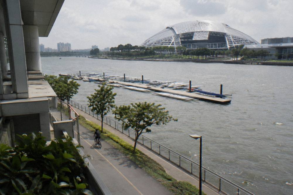
Downstream, the corridor passes the Basin, where the water widens and the rowing and water-sports facilities sit. Past that is the stadium precinct. From there the connections branch: coastal paths lead toward East Coast Park and the eastern park connectors, and other strands head north toward the reservoir district.
Two operators on the tour list start at Esplanade Mall: City Scoot's 4-hour small-group ride and its 2-hour river route. Both meet at City Scoot at Esplanade Mall, which sits within easy reach of the river mouth. A rider joining one of those rides is, in effect, starting at the river-mouth end of the Kallang corridor.
The Kallang River has also been through a substantial transformation. The result today is a river that looks like a river for most of its city run, which is why so many guided routes use it.
Two nearby alternatives in that selection start over in Punggol. The 5-Hour Nature Ride from The Cycle Startup starts further east at GoCycling @ Punggol Park and works the nature corridors of the north-east, but it shares the same logic as the Kallang routes: flat terrain, regular bicycles, water and greenery the whole way. The Sunrise Ride starts at Punggol Field for from $48.02 per person, and City Scoot's river route starts at Esplanade Mall for from $47 per person.
How Do You Ride From The Kallang River To The City And The Water?
The route logic is simple: the river runs roughly from the north-east to the city, so a rider at the Basin can follow the water in either direction. West and south toward the river mouth brings you to the Marina Bay precinct and the city. East along the coast brings you to the beach park chain. Both directions run on shared paths marked with red lines, and both have slower sections where the path crosses roads.
The citybound direction is the one most visitors do first. From the upper river, the path runs toward the bay, crossing zones where pedestrians mix with cyclists. The night cycling guide covers the same corridor after dark, and it is one of the better night rides on the island: the city skyline sits at the end of the river, lit, and the path is wide enough that it stays rideable with lights on.
The seaward direction is flatter and greener. The Basin opens up past the stadium, and from there the coastal parks begin. Riders heading that way often continue to East Coast Park, which is treated in full in the East Coast Park cycling guide. The connection from the river to the coast is one of the most pleasant point-to-point rides available to a visitor, all on paths, almost all of it beside water.
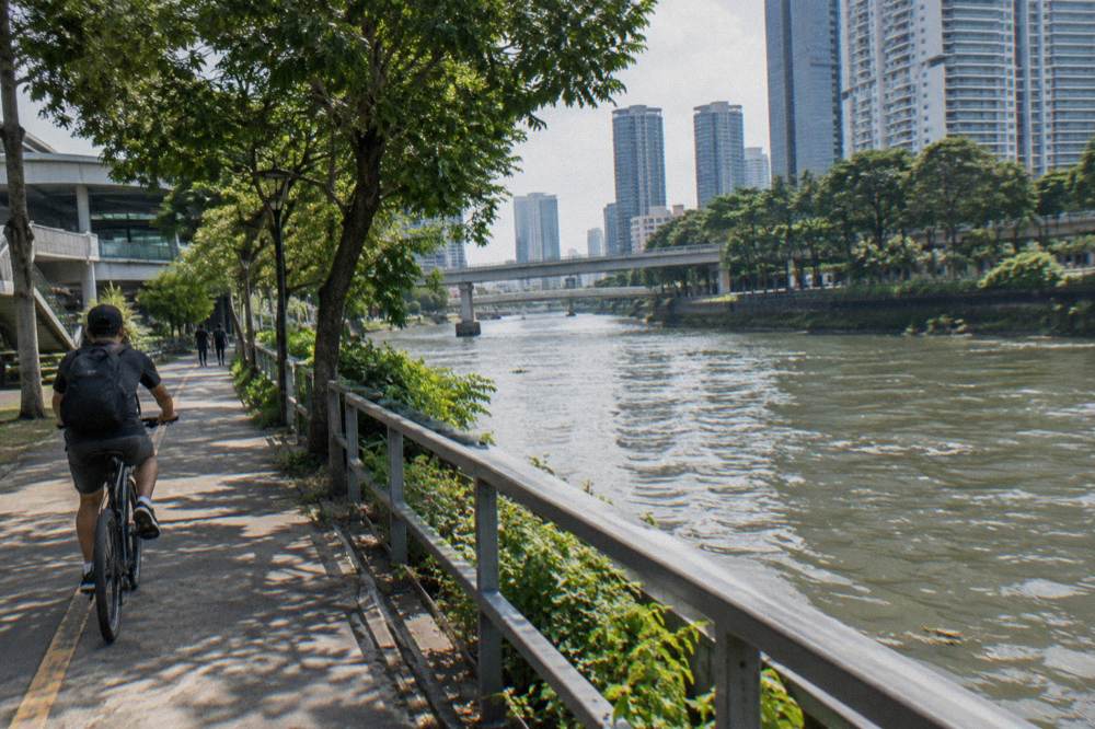
Two cautions apply. First, the path type changes. NParks distinguishes shared paths, marked with both cyclist and pedestrian logos and red continuous lines, from segregated paths, where a footpath runs beside a cycling path, and from Attention Zones, marked with red dotted lines near bus stops, crossings and playgrounds, where cyclists are expected to slow down and give way. A rider who knows those three markings reads any connector on the island without a map.
Second, the area sits inside the newer path typology. NParks has been piloting a revised PCN typology since 2022 that segregates stretches into pedestrian-only and shared paths, and Phase 2 of that pilot covers Tanjong Rhu Park Connector, Gardens by the Bay, Marina Barrage, the Singapore River Promenade and the Punggol connector, among others. Tanjong Rhu sits directly on the Kallang corridor. In practical terms: some footpaths beside the cycling paths in this area are now Pedestrian-Only Paths, and bicycles are not allowed on them. Ride on the cycling side.
The change is enforced. Since 1 July 2025, riding a bicycle on a Pedestrian-Only Path carries a penalty of up to $2,000 and/or up to three months imprisonment for a first offence, per the Land Transport Authority's enforcement release. The same release notes that enforcement officers take a measured approach except toward riders who speed or ride recklessly.
Route Choices On The Kallang Corridor
| Route idea | Direction | Character | Best for |
|---|---|---|---|
| River mouth to the Basin | City to north-east | Riverside shared path, skyline behind you | A first ride, a short outing |
| Basin to the stadium precinct | Along the water | Wide paths, water sports views | Families, casual riders |
| River to East Coast Park | West to east | Connector to coastal park chain | A half-day point-to-point |
| Kallang to Marina Bay loop | North-east to south | River plus waterfront loop | Evening and night rides |
| Tanjong Rhu stretch | Along the strait | Narrower, segregation pilot area | Quieter riding, local feel |
The table is a planning aid, not a set of fixed itineraries. Exact entry and exit points are easiest to pick on the NParks park connector map, and guided rides remove the planning problem entirely by choosing the route for you.
A guided option worth flagging for this corridor: the 5-Hour Nature Ride from The Cycle Startup, rated 5.0 across 37 reviews, uses the network of nature corridors around the eastern side of the island. It starts from GoCycling @ Punggol Park, includes the bike, a helmet, a bandana and bottled water, runs with a group capped at four riders, and costs from $84.04 per person. Snacks, insurance and lunch are not included, and the listing notes free cancellation.
What Do Guided Tours On The Kallang River Cost?
Guided rides that start near or use the Kallang corridor cost from $47 to $104.05 per person depending on format and length, with shorter group routes at the low end and longer private or food-focused rides at the high end. All prices are per person on a regular bicycle, and most listings show free cancellation. A 2-hour river ride starts at $47, a 4-hour small-group city ride at $64.03.
- Up to 2 hours4 tours
- 3 to 4 hours17 tours
- 5 to 6 hours1 tour
- 7 hours or more1 tour
The cheapest way onto a guided ride in this part of the island is the 2-hour format. City Scoot's River Route via F1 Track starts at City Scoot at Esplanade Mall, includes the bike, helmet and bottled water with a licensed local English-speaking guide, caps the group at 12, and costs from $47 per person. It is rated 5.0 across 14 reviews. The route runs the river and bay precinct, and the short duration suits riders who want the orientation without a half-day commitment.
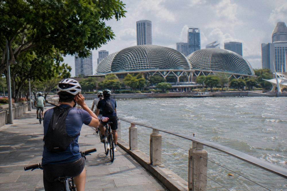
The 4-hour formats cover more. The same operator's Small Group ride, max 10 guests, costs from $64.03 per person and is rated 4.8 across 74 reviews. It adds bag storage and a raincoat to the inclusions, and asks riders to arrive 15 minutes early for bike fitting. The Brompton Bike, Coffeeshop Coffee Stop option from 808 Tours, rated 5.0 across 14 reviews, starts at King Albert Park instead, includes coffee or tea, a licensed guide and a Brompton folding bike, and costs from $96.05 per person.
Guided Rides Near The Kallang Corridor, From Price Per Person
Prices are per person on a regular bicycle, group sizes as listed
Private formats cost more and remove the group variable. The Private City Ride from HR Assist runs 4 hours, includes the bike, bottled water and a poncho, excludes alcohol, and costs from $160.08 per person. The Full-Day Private Ride from Singapore City Explorers runs 7 to 8 hours with food tastings, lunch, a guide, helmet and bottled water, from $224.11 per person. It has 9 reviews; its operator describes it as a private format.
Guided Rides Near The Kallang Corridor
| Tour | Duration | From, per person | Group | Reviews |
|---|---|---|---|---|
| River Route via F1 Track, City Scoot | 2 hours | $47 | Max 12 | 14 |
| Small Group city ride, City Scoot | 4 hours | $64.03 | Max 10 | 74 |
| Light to Night, Bike Around Tour | 3 hours | $60.03 | Max 8 | 243 |
| Bike and Bites, Let's Go Tour | 3 hours | $79.24 | Max 15 | 282 |
| Brompton Bike, Coffeeshop Coffee Stop, 808 Tours | 4 hours | $96.05 | Max 10 | 14 |
| Private City Ride, HR Assist | 4 hours | $160.08 | Private | 17 |
Two of the longer-established operators in the table are worth a note. The Licensed Guide, Poncho Included ride from Bike Around Tour, rated 5.0 across 6,579 reviews, costs from $68.03 per person and runs 4 hours with a licensed local guide, a bike and a poncho, with a group capped at 12; it excludes insurance, and luggage storage needs to be arranged by email in advance. The Full-Sized Bikes, Small Group ride from Lets Go Tour, rated 5.0 across 1,559 reviews, costs from $64.03 per person and includes a local snack and a local drink alongside the bike, helmet and bottled water.
The Marina Bay Night Ride from the same stable, rated 4.9 across 598 reviews, costs from $48.02 per person for 2 hours and starts at Let's Go Tour Singapore rather than Esplanade. None of these listings include hotel pickup, so plan to make your own way to the meeting point.
What Rules Apply When Cycling The Kallang Park Connector?
The connector is governed by the Active Mobility Act rules: a 25 km/h maximum on shared and cycling paths, 10 km/h on footpaths where riding is allowed, give way to pedestrians, and slow down at Attention Zones marked with red dotted lines. Bicycles are banned from Pedestrian-Only Paths beside dedicated cycling paths, a rule enforced since 1 July 2025. Lights, front white and rear red, are required in the dark.
The full framework is on the LTA's rules and code of conduct page, which sets out device criteria and rider obligations in detail. The essentials for a visitor on a rental or tour bike: no mobile phone in hand while riding, dismount and push at No Riding signs, stop and look before crossing a road, and keep left except when overtaking. The same page states that a helmet is mandatory when riding on roads, and NParks advises helmets on the park connectors even where they are not legally required. More of these guides are collected on Singapore Bike Tours.
| Path type | Marking | Speed limit | Bicycles allowed |
|---|---|---|---|
| Shared path | Cyclist and pedestrian logos, red lines | 25 km/h | Yes |
| Cycling path | Cyclist logo, red or dark grey | 25 km/h | Yes |
| Footpath | Unmarked path beside roads | 10 km/h | Yes, where not converted |
| Pedestrian-Only Path | Beside a cycling path | Not applicable | No, since 1 July 2025 |
| Road | Follow the road limit | Road limit | Yes, helmet mandatory |
The Pedestrian-Only Path conversion is the one recent change a visitor genuinely needs to know. Footpaths adjacent to dedicated cycling paths, including in Phase 2 pilot areas such as Tanjong Rhu, have been converted, and the LTA began enforcement on 1 July 2025. First offences carry up to $2,000 and/or up to three months imprisonment, a penalty specific to this offence. Standalone footpaths and shared paths are unaffected.
Practical habits matter more than the fine print on a pleasant riverside ride. Riders on the connector are expected to give way to pedestrians, slow near bus stops, crossings and fitness corners, and walk the bike in crowded areas. In practice, the Kallang corridor is wide enough that conflicts are rare outside peak park hours, but weekend afternoons near the stadium and the water-sports clubs do get busy. The etiquette page for the park connectors covers the same expectations in the same terms.
None of this requires a helmet by law on the paths. Most tours here include a helmet in the base price, and many also provide a poncho if the weather turns; check the listing for what is covered. On roads the helmet is mandatory, and the Traffic Police stepped up enforcement against non-compliance in early 2026, so a rider mixing path and road segments should wear one throughout.
When Is The Best Time To Ride The Kallang Corridor?
The best riding weather sits in the drier stretch from February to May, when monthly rainfall drops to between 105.1 and 164.3 mm against November's 252.3 mm, and sunshine runs around 6 to 7 hours a day. November and December bring about 19 rain days each, easing off through January. Early morning rides avoid both the heat and the afternoon convection showers.
Those figures come from the Meteorological Service Singapore's 1991 to 2020 climate normals for Changi. February is the driest month on the record, November and December the wettest, and the hottest month is May with a 24-hour mean of 28.6 degrees Celsius. The coolest months are December and January at 26.8 degrees, which is still warm by temperate standards: the mean daily max never falls below 30.5 degrees in any month.
| Month | Mean temp, C | Rainfall, mm | Rain days | Sunshine, h/day |
|---|---|---|---|---|
| Feb | 27.3 | 105.1 | 8.5 | 7.0 |
| Mar | 27.8 | 151.7 | 12.1 | 6.3 |
| Apr | 28.2 | 164.3 | 14.9 | 6.1 |
| May | 28.6 | 164.3 | 14.5 | 6.0 |
| Jun | 28.5 | 135.3 | 13.2 | 5.8 |
| Nov | 27.2 | 252.3 | 19.0 | 4.4 |
The seasonal advice in the best time to cycle guide unpacks this in more detail, including what to do when the rain does arrive, but the short version for the Kallang corridor is this: the river and Basin hold heat, the path is exposed in stretches without tree cover, and the afternoon build-up is real. A 7am start beats a 2pm start in every month of the year.
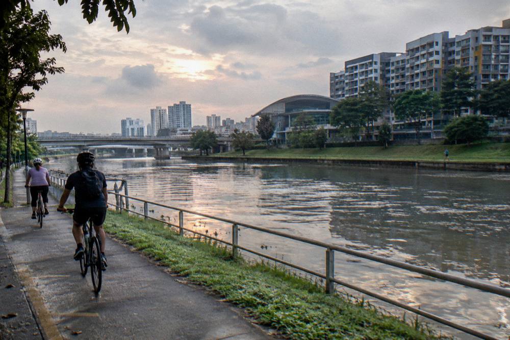
Sunrise rides exist as a product, and they exist for this reason. The Sunrise Ride, Local Breakfast tour starts at Punggol Field, runs 3 to 4 hours with a group capped at five, and includes breakfast, a souvenir, bottled water, a helmet and a poncho, from $48.02 per person. It has 3 reviews on its listing. The start time is early enough that the ride finishes before the day's heat builds, and the included breakfast is a local one rather than a hotel buffet.
Rain is not a reason to cancel outright. The cycling in the rain guide covers the practicalities, and most tours here include a helmet; many include a poncho too. Several listings state plainly that the tour runs rain or shine.
What Should You Bring On A Kallang Park Connector Ride?
Bring water, sun protection and a light layer for rain, and let the tour handle the rest: every guided ride covered here includes the bicycle, and most include a helmet and bottled water or a rain poncho. Wear closed shoes and light clothing, carry a phone mount or a pocket for navigation, and plan to arrive 15 to 20 minutes before departure for bike fitting and the safety briefing.
- Jan222 mm
- Feb105 mm
- Mar152 mm
- Apr164 mm
- May164 mm
- Jun135 mm
- Jul147 mm
- Aug147 mm
- Sep125 mm
- Oct168 mm
- Nov252 mm
- Dec332 mm
Rain-days run from 8.5 (driest month) to 19.3 (wettest month).
The inclusion lists are worth reading before booking, because they differ. Some tours include food, some do not. The Katong Food Ride includes snacks and foods with a licensed guide and a bike, from $96.05 per person, rated 5.0 across 337 reviews. The Bike and Bites ride from Let's Go Tour includes shared local bites that the operator describes as a cultural introduction rather than a full meal, from $79.24 per person, rated 4.9 across 282 reviews. Neither is a lunch replacement on its own terms.
The clothing question is answered in full in the what to wear guide: light, breathable fabrics, a cap under the helmet for sun, and nothing that chafes after two hours in a warm climate. Singapore's mean annual relative humidity sits at 82 percent, so sweat does not evaporate quickly, and a rider unused to tropical conditions feels it on the second hour.
Hydration is the one item that genuinely matters. Riders going independently should carry more water than they think they need. Singapore's heat and humidity drain you faster than a short ride suggests, and guided tours often handle refreshments, so a solo trip leaves you to plan for yourself. Check the tour listing to see whether water is included before you set off. Sunscreen and sunglasses finish the kit.
Which Guided Ride Fits The Kallang Corridor Best?
For a short visit, the 2-hour River Route via F1 Track from City Scoot at $47 per person is the most direct guided way onto the corridor. For a fuller half-day, the 4-hour Small Group city ride at $64.03 covers more ground with a group capped at 10. For nature over skyline, the 5-Hour Nature Ride at $84.04 moves east along the same flat island terrain toward the coast.
The choice reduces to time and interest. A rider with one free morning who wants the skyline and the river takes the short route. A rider who wants the city explained takes a 4-hour format with a licensed guide. A rider who wants green and water rather than buildings takes the eastern nature corridors.
- Small group13 of 23
- Private5 of 23
- Group type not stated5 of 23
The private formats are a different purchase: from $160.08 to $224.11 per person, they buy exclusivity and flexibility rather than distance. Families and small groups often find the maths works out, solo riders usually do not.
The one thing every format shares is the bicycle. Every tour on this site uses a regular, non-electric bike, and the Kallang corridor is flat enough that nobody misses the motor. That is also why the corridor works so well for first-time visitors: the effort level is low, the scenery is constant, and the city is always either behind you or in front of you, depending on which way you point the handlebars.
Whether you ride it with a guide or on your own, the Kallang Park Connector is the cleanest link between the city and the water on this side of the island, and it is the reason so many guided routes begin within a few hundred metres of its city end.
Common Questions About Kallang Park Connector Cycling
Where Does The Kallang Park Connector Start?
The practical start for visitors is the city-side end near the river mouth, reachable on short connecting paths from the Esplanade and City Hall area. Several guided rides meet at Esplanade Mall, which sits within easy reach of the river-mouth end of the corridor.
Can Tourists Cycle The Kallang Park Connector Without A Guide?
Yes. The connector is a public shared path open to anyone on a compliant bicycle, and bike rental is available in Singapore. A guided tour adds a licensed local guide, route decisions and included extras like water and ponchos, but independent riding on the corridor is normal and legal.
What Is The Speed Limit On The Kallang Park Connector?
The maximum is 25 km/h on shared and cycling paths, and 10 km/h on footpaths where riding is permitted. Bicycles are not allowed on Pedestrian-Only Paths beside dedicated cycling paths, a rule enforced since 1 July 2025 with penalties of up to $2,000 and/or three months for a first offence.
How Much Does A Guided Bike Tour Along The Kallang River Cost?
Group rides that start near the corridor run from $47 to $104.05 per person depending on length and inclusions, and private formats start higher. The 2-hour River Route via F1 Track from City Scoot costs from $47 per person, and the 5-Hour Nature Ride from The Cycle Startup costs from $84.04 per person.
Is The Kallang Park Connector Suitable For Beginners?
Largely yes. The corridor is flat, the shared paths are wide in most sections, and the terrain puts no demand on fitness. The cautions are heat and traffic density at peak times: start early, carry water, and slow down in the Attention Zones marked with red dotted lines near crossings and bus stops.
Do You Need A Helmet To Cycle The Kallang Park Connector?
Not on the paths, where NParks advises a helmet rather than mandating one. On roads a helmet is mandatory for cyclists under LTA rules, and Traffic Police enforcement against non-compliance was stepped up in early 2026. Most guided tours include a helmet or provide one on request.